Travel blog OnTourWorld
  • HOME
  • TRAVEL REPORTS
    • Europe
      • Spain
      • Portugal
      • France
      • Ireland
      • Italy
      • Croatia
      • Netherlands
      • Austria
    • Africa
      • South Africa
      • Mauritius
      • Seychelles
      • Egypt
    • America
      • Hawaii
      • New England
      • New York
      • Arizona
      • Ecuador
      • Galapagos
      • Canada
      • California
      • Mexico
      • Dominican Republic
      • Puerto Rico
      • Bermudas
      • Bahamas
    • Asia
      • Bali
      • Hong Kong
      • Java
      • Maldives
      • Philippines
      • Singapore
      • Sri Lanka
      • Thailand
      • Turkey
    • Oceania
      • Australia
      • New Zealand
      • South Sea
  • CITY TOURS
  • Country information
  • Forum
  • SERVICE
    • Videos
    • Imprint
    • Data protection
  • German
  • English
Dominican Republic- La Romana
Dom Rep

Dom Rep – La Romana

by Joe OnTour 23. August 2017
written by Joe OnTour

Dominican Republic – La Romana

La Romana is a city in the southeast of the Dominican Republic. Here you will find hotel complexes of simple style but also more exclusive resorts for the individual tourist.

The largest share of the Dominican Republic’s economic revenue comes from tourism. Most tourists come from the USA. This is followed by Europeans, mainly Germans. The main tourist areas are in the north and southeast of the Dominican Republic. The towns in the north are Puerto Plata, Sosua and Cabarete.

To the southeast are the towns of Punta Cana, Boca Chica, Juan Dolio and La Romana. The capital Santo Domingo is definitely worth a visit. Here you will find the oldest buildings of the New World. The Samana region has so far been spared from mass tourism, as many tourists do not accept the long journey of 3-5 hours. The most frequented tourist places are Las Terrenas and Las Galeras.

The tourist strongholds can be easily booked from Europe. However, if you want to make domestic flights or package bookings as an individual tourist to explore the island further and to travel to more distant areas, you have to make an effort in the country itself, as tour operators rarely cover this area.

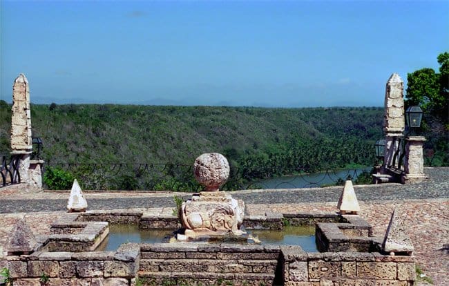
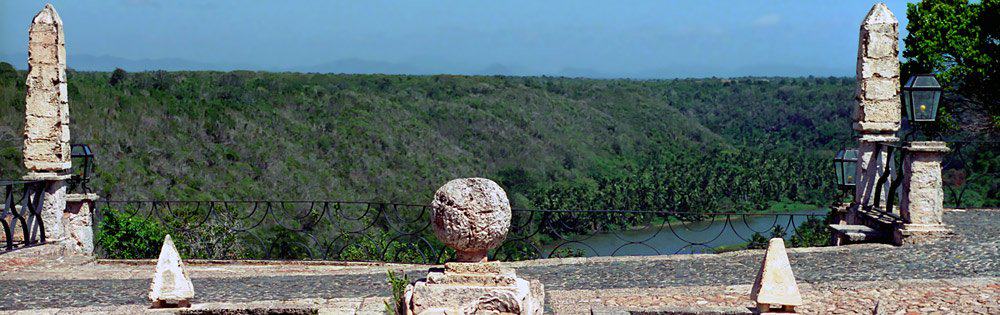
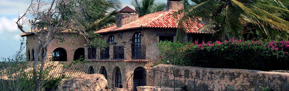
We therefore organized our exploratory trips on our own on site. Our port of call was a resort complex in La Romana in the southeast of the island. From here we explored the island by rental car. The resort complex has comfortable rooms in small houses, each with two to three units, with a large communal living room on the ground floor.

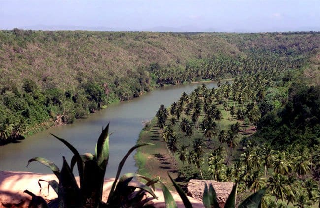
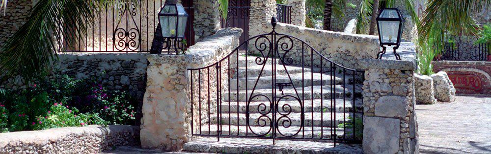
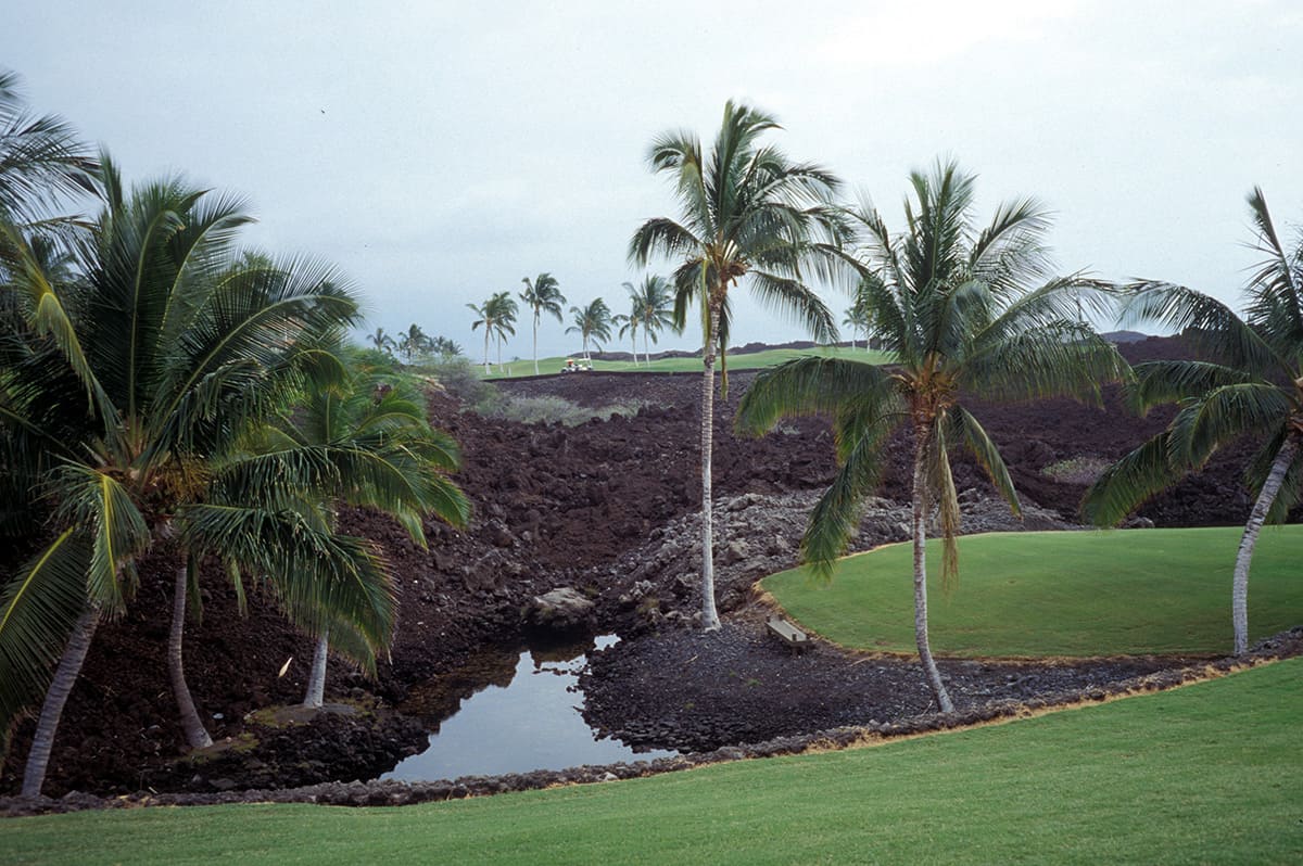
The houses are embedded in a spacious and extensive park landscape. The complex also has its own golf course, a polo court and its own beach area.

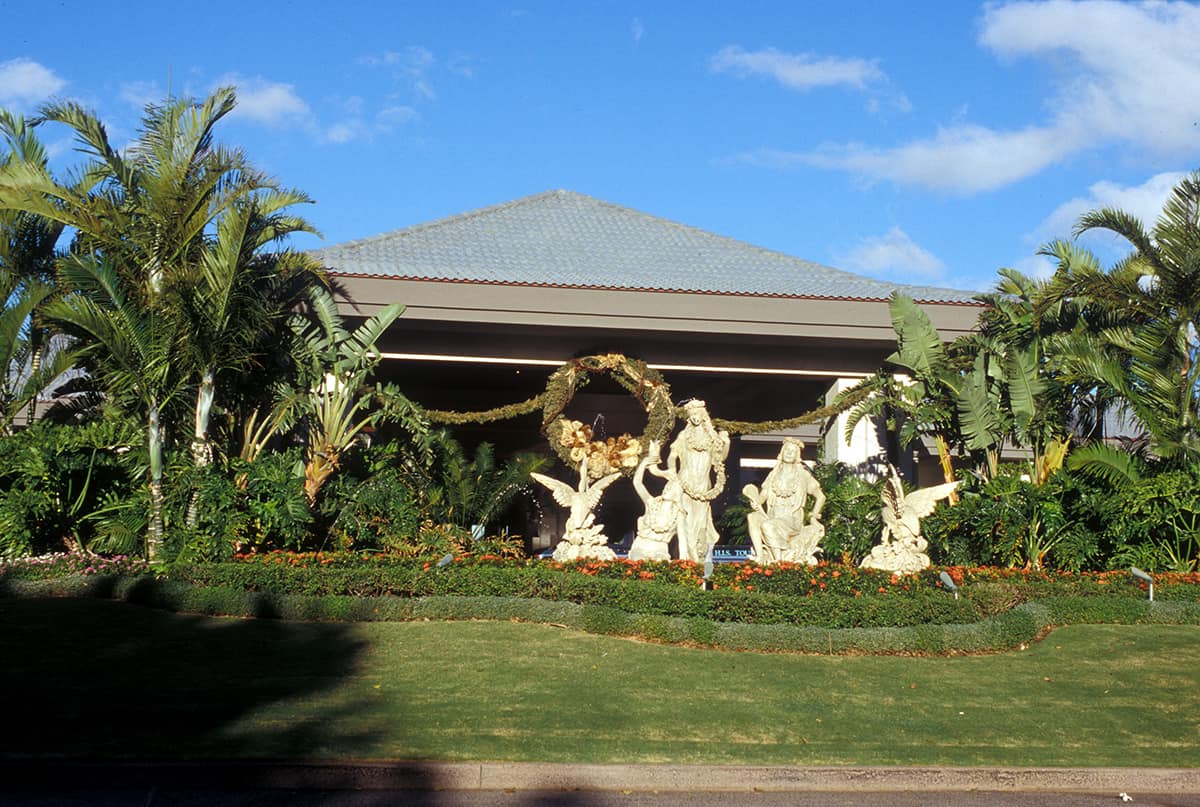
The interior is cozy and homely. There was also no skimping on small accessories that make the stay pleasant. Of course, you will find the usual infrastructure such as restaurants, lobby, etc. in the main building.

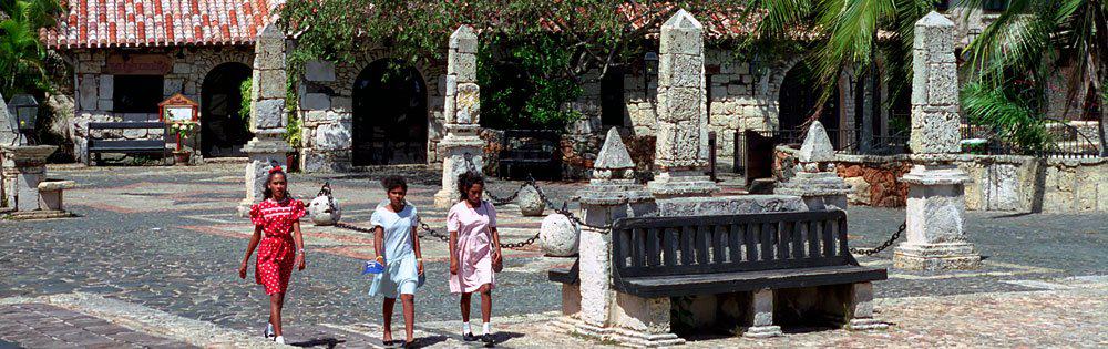
Photos Dominican Republic – La Romana
Dominikanische Republik
OnTourWorld Reiseberichte Dominikanische Republik
Dominikanische Republik
OnTourWorld Reiseberichte Dominikanische Republik
Dominikanische Republik

Questions about the destination Dominican Republic?

In the America Forum you will get the answers!

23. August 2017 0 comments
0 FacebookTwitterPinterestEmail
Puerto Rico
Puerto Rico

Puerto Rico 1

by Joe OnTour 19. July 2017
written by Joe OnTour

Puerto Rico

The Free State of Puerto Rico is one of the U.S. territories, an island state in the Caribbean associated with the United States, consisting of the island of Puerto Rico and the smaller neighboring islands of Vieques, Culebra, Culebrita, Palomino, Mona and Monito. Puerto Rico is the easternmost and smallest island of the Greater Antilles. Puerto Rico means “rich port”.

Puerto Rico was discovered by Christopher Columbus on his second voyage in 1493. As a result, Puerto Rico became part of the Spanish dominion. Fifteen years later, colonization began under Juan Ponce de León. This led to the extermination of the local Indians. After that, black slaves were introduced for work. Slavery was officially abolished in 1873. A year later, the Americans annexed Puerto Rico as a result of the Spanish-American War. With the passage of the Jones Act in 1917, Puerto Rico was once again granted internal self-government. In 1952, the island was granted the status of Dominion Estado Libre y Asociado de Puerto Rico (Commonwealth of Puerto Rico).

Satellite image with zoom: Read travel reportRead travel report Puerto Rico – Map
The island has a subtropical climate throughout the year, with average temperatures of around 28°C. The most frequent rainfall is recorded on the north coast and in the highlands. In the south of the island it is relatively dry. The island is mountainous with rainforests, deserts and beautiful long white sand beaches. More than 80% of the 4 million Puerto Ricans are Catholic. Although the island belongs to the USA, only about 10% describe themselves as Americans. 87% of Ricans see themselves as descendants of the Spaniards or as descendants of African slaves. Spanish is spoken as a first language by over 93% of the population, and universities mostly teach only in English. Agricultural products include sugar cane, bananas, coffee, pineapple, and tobacco. Another industry is fishing. In addition, there are such industries as the food, textile, cement and mechanical engineering industries. One of the other most important economic sectors is tourism.

Pictures Puerto Rico

Puerto Rico
Puerto Rico
Puerto Rico
Puerto Rico
Puerto Rico
Puerto Rico
Puerto Rico
Puerto Rico
Puerto Rico

Questions about Puerto Rico?

In the America Forum you will get the answers!

19. July 2017 0 comments
0 FacebookTwitterPinterestEmail
Bermudas
Bermuda

Bermuda

by Joe OnTour 19. July 2017
written by Joe OnTour

Bermuda

Bermuda is a group of islands in the Atlantic Ocean, which is part of the United Kingdom (UK) as a British Overseas Territory. It is located east of the U.S. state of North Carolina.

The Bermuda Islands are best known for the Bermuda Triangle and because of the Bermuda shorts. After the Second World War, the economy took off and Bermuda has developed into a very successful financial centre. In 1968, Bermuda received its constitution. However, independence was rejected in a referendum in 1995. Bermuda is an overseas territory of the United Kingdom with the head of state of Queen Elizabeth II. It is represented by a Governor General appointed by it. Important political decisions, such as foreign and defence policy, are taken directly by the government in England.

Climatically, the Bermuda Islands are one of the subtropical, humid and warm regions. In January, however, temperatures of a cool 5 degrees can also prevail. September is the month with frequent hurricanes. The highest “mountain” in the country is Town Hill at 79 meters. The island is surrounded by coral reefs. They are the northernmost on this earth. Rainwater is collected in cisterns because there are no rivers on the islands. Subtropical vegetation with rubber trees and sage species predominates. The Bermuda cedar is particularly characteristic. Mangroves can also be found on various stretches of coast. The main source of income is tourism, which accounts for a whopping 40% of the gross domestic product.

Ninety percent of the tourists come from the nearby USA. Occasionally, Europeans also get lost on the islands, although they usually only visit the main island. Bermuda has some very beautiful golf courses.

Bermuda is known as a tax haven with low tax rates. Therefore, many credit institutions and insurance companies have settled here. Due to the subtropical climate, intensive agriculture can be practiced. Among other things, tropical fruits, potatoes, vegetables, tobacco and flowers are grown. Fishing is of little importance, it is mainly carried out for the local population’s own supply. It is only allowed to drive one car for one family at a time in Bermuda. Tourists can choose between bicycles, buses, taxis, horse-drawn cabs and mopeds. By the way, the moped is the most used means of transport in the Bermuda Islands. 70% of the population are blacks and mulattoes, 30% are white. The coloured people are mainly descended from the African slaves. The whites are of British origin. The capital city of Hamilton has a population of about 3,000. The city is small and dreamy and still has the flair of the former colonial era. Sometimes the large cruise ships and luxury liners dock here directly on the main road. With their sometimes 10 floors or higher, they look like giants in a toy store in the small idyllic town, where the houses are only 3-4 stories high. Then Hamilton is suddenly overpopulated and you should leave the city in a hurry, because legions of tourists attack everything that looks like souvenirs.

The official and colloquial language is British English. The majority of the inhabitants are Protestant. 15% are Roman Catholic. The standard of living in Bermuda is very high. There is virtually no unemployment. More than 80% of the government budget is reserved for the resorts, social benefits and education. The inhabitants of Bermuda are very flexible in their choice of work. You are not afraid to accept work for which you have no concrete training, for example. The integration of the different skin colors works exemplarily in Bermuda. The crime rate is extremely low. The famous British tradition is maintained on the Bermuda Islands. You can see this in all life situations, from clothes to the kitchen.

Pictures of Bermuda

Bermudas
Bermudas
Bermudas
Bermudas
Bermudas
Bermudas
Bermudas
Bermudas

Questions about Bermuda?

In the America Forum you will get the answers!

19. July 2017 0 comments
0 FacebookTwitterPinterestEmail
Bahamas
Bahamas

Bahamas

by Joe OnTour 18. July 2017
written by Joe OnTour

Bahamas

West Indies. They are located southeast of the USA and northeast of Cuba and are counted as part of Central America. Of the more than 700 Bahama islands, only 30 are inhabited. The archipelago got its name from the Spanish conquistadors, who called the waters around the islands Baja Mar (Spanish for “shallow sea”) which later became the Bahamas. The official language is English. The capital is Nassau. The head of state is Queen Elizabeth II. The Bahamas has an area of 13,940 sq km. The Bahamas has a population of 300,000 and a population density of 21.8 inhabitants/sq km. They became independent from Great Britain on 10.7.1973. The currency is the Bahama Dollar (BHD). The time zone is EST = UTC -5.

The Bahamas is made up of over 700 islands, of which only 30 are inhabited, and around 2,400 coral reefs (the cays). The Bahamas stretches from the southeast coast of the USA along the northeast coast of Cuba to the northwest coast of the Turks and Caicos Islands. They have a north-south extension of about 650 km and a west-east width of up to about 750 km. The most inhabited islands are New Providence, Grand Bahama and the Out Islands. The highest point in the Bahamas is Mount Alvernia at 63 m on Cat Island. The largest island in terms of area is Andros with 5,957 km².

The Bahamas has a mild and subtropical climate. In summer, the average temperature is around 28°C. In winter, temperatures rarely drop below 20°C. The annual average is 26°C. The two most important cities are the capital Nassau and Freeport. More than three-quarters of the population live in both together. With its more than 200,000 inhabitants, Nassau is by far the largest city in the island state.

African Americans make up the largest proportion of the island’s population, accounting for 85%. The remaining 15% are divided into 12% of European origin, as well as 3% of Siberian and Latin American origin. Since the middle of the 20th century, the island state, which is part of the Commonwealth of Nations, has been considered a tourist destination and tax haven. About 300,000 people live in the Bahamas today. The country has no significant raw materials, so the economy is heavily dependent on tourism and banking.

Photos Bahamas

Bahamas
Bahamas
Bahamas
Bahamas
Bahamas

Questions about the destination Bahamas?

In the America Forum you will get the answers!

18. July 2017 0 comments
0 FacebookTwitterPinterestEmail
Arizona – General Information
ArizonaGeneral country information

Arizona – General information

by Joe OnTour 12. July 2017
written by Joe OnTour

Arizona General Information

Area: 294,333 km².

Population: around 7.6 to 7.7 million (as of 2025/26) – significantly more than the previously mentioned 5.86 million (as of 2005); an increase of around 30% within two decades, which continues to make Arizona one of the fastest-growing US states.

The ethnic composition has changed noticeably since 2005: the proportion of Latinos and Hispanics is now over 30% (significantly higher than in previous decades), the proportion of the white, non-Hispanic population is now around 53–55% (instead of the previously mentioned around 80%). The Navajo and Hopi continue to be among the most important indigenous population groups; a total of over 300,000 members of indigenous peoples live in Arizona today (significantly more than the previously mentioned 200,000), spread over 27 state-recognized tribes – around a quarter of Arizona’s land area is Indian reservations, including the Navajo Nation, the largest Indian reservation in the entire USA.

Population density: around 26 inhabitants per km² (up from the previously mentioned 20).

Capital: Phoenix.

Inhabitants of Phoenix: The core city today has around 1.6 to 1.7 million inhabitants (instead of the previously mentioned 1.43 million in 2005), the entire metropolitan area (Metro Phoenix) today has just under 5 million people – making Phoenix the fifth largest city in the USA today.

Geography: The landscape of Arizona is known from numerous films and is mainly characterized by barren plateaus, mountains, bizarre rock formations and wide desert plains. The three most famous national parks are the Grand Canyon, Painted Desert and Petrified Forest. In the Grand Canyon, the oldest exposed rock layers on earth are visible, dating back up to 2 billion years. Phoenix, the capital of Arizona, is a green oasis in the middle of a sand and mountain desert.

Local time: CET − 8. Arizona does not participate in any daylight saving time changes (with the exception of the Navajo Nation, which adopts daylight saving time). The time difference with Central Europe is therefore −8 hours in winter and −9 hours in summer.

General: Arizona is a state in the southwestern United States, bordered by Utah to the north, New Mexico to the east, Sonora and Baja California to the south, and California and Nevada to the south. A large part of the western border is formed by the Colorado River.

Arizona became the 48th state to join the USA on February 14, 1912. The economy has developed rapidly since the 1950s, making Arizona an important center of the so-called Sun Belt; today, in addition to tourism and agriculture, high-tech industry and semiconductor manufacturing (including large new chip factories in the Phoenix area) are increasingly playing a growing economic role.

The name of the state is probably derived from the word “Arizonac”, which means “place of the small spring”.

The most important cities continue to be the state capital Phoenix, Tucson, Mesa, Glendale, Tempe and Scottsdale as well as the suburbs in the greater Phoenix area, which have grown strongly in recent years (including Chandler, Gilbert, Peoria).

Administration and politics: Arizona is governed by the Constitution of 1912. The executive branch is headed by the governor, elected by the people for a four-year term (there is no lieutenant governor in Arizona). Legislation is legislated by the Senate and House of Representatives, both elected for a two-year term.

Current governor: Katie Hobbs (Democratic Party), in office since January 2023 – Arizona’s first Democratic governor since 2009 and the fifth woman to hold this office in the state’s history. Hobbs won the 2022 election by the narrowest of margins against Republican candidate Kari Lake and is running for re-election in 2026, with Arizona being considered a politically hard-fought “swing state”.

Arizona – Entry and Visa

German, Austrian and Swiss nationals can enter the USA for tourist and business stays of up to 90 days under the Visa Waiver Program (VWP) without a classic visa. The prerequisite is prior online registration via the electronic entry system ESTA (Electronic System for Travel Authorization), which should be applied for at least 72 hours before departure – preferably much earlier – via the official website esta.cbp.dhs.gov. The fee is 21 US dollars; an approved ESTA is usually valid for two years or until the expiry of the passport and entitles you to multiple entries.

The prerequisite is a biometric, machine-readable passport and the absence of certain exclusion criteria (including relevant criminal records or previous travel to or dual citizenship of Iran, Iraq, North Korea, Sudan, Syria or Cuba since 2011) – in such cases, a regular tourist visa (B1/B2) at the US embassy is required instead.

The use of unofficial third-party websites that charge excessive fees for the ESTA application is not recommended – the application should only be made via the official government website. Since US entry requirements can change at short notice, it is advisable to take a look at the current information from the Federal Foreign Office and the US Embassy before each trip.


Note: All information on population figures, political offices and entry requirements is subject to change and has been researched to the best of our knowledge as of August 2026. For up-to-date, binding information on ESTA/entry, it is advisable to take a look at esta.cbp.dhs.gov as well as the travel and security advice of the Federal Foreign Office before travelling.

Questions about Arizona?

In the America Forum you will get the answers!

12. July 2017 0 comments
0 FacebookTwitterPinterestEmail
Arizona - Harley Davidson
Arizona

Arizona – Harley Davidson

by Joe OnTour 12. July 2017
written by Joe OnTour

Arizona – Harley Davidson

Arizona, and especially the Scottsdale area, is a popular location for Harley Davidson riders.

We found an exclusive store in Scottsdale that only sells Harley Davidson motorcycles.

A specialty of this workshop is the tuning of Harleys. However, many special accessories are also offered in the shop. In addition, there are a plethora of accessories such as headscarves, watches and clothing.

We are not Harley riders ourselves, but this brand has always fascinated us and it is just fun to browse and talk shop here. You can also rent a Harley here and explore the wonderful Arizona countryside on two wheels.

Pictures Arizona – Harley Davidson

Arizona - Harley Davidson

Questions about Arizona?

In the America Forum you will get the answers!

12. July 2017 0 comments
0 FacebookTwitterPinterestEmail
Arizona - Golf Courses
Arizona

Arizona – Golf Courses

by Joe OnTour 12. July 2017
written by Joe OnTour

Arizona – Golf Courses

Scottsdale in Arizona is a mecca of golf. Here you will find a variety of places in a very small space. A good base and starting point for exploring the region is the Phoenix Hotel in Scottsdale with its two hotel-owned 18-hole golf courses “Phoenician”.

Directly on the grounds of the hotel is the “Phoenician” golf course of the same name with 36 holes, which belongs to the hotel. The grounds of the Phoenician Golf Club are an ideal opportunity to acclimatise and get fit for the other courses in the region. The clubhouse is typically American, pompous and dignified.

Of course, the famous American service can be felt everywhere. In contrast to Europe, America is an absolute service country. If you want to play here during the high season, you should reserve the tee times well in advance, as they are often blocked for weeks in advance. This can be organized by e-mail or fax, for example, right before your departure from Europe.

The green fees of the two 18-hole golf courses are very well maintained. The course is varied and has not only the usual sand bunker but also water hazards. In addition, the golf courses are embedded in a small mountain and rocky landscape, which adds a lot of spice to the joy of playing. The Fairwas are planned broadly and generously and are very much in line with the European style of play.

A course leads directly through the small mountains and some holes are challenging to play. But the course is very varied and you have a new perspective and a new panorama from every tee.

In some places there are warnings about the Rattle Snakes, which are everywhere here in the desert.

In the wider Phoenix catchment area alone, there are well over 100 golf courses. The focus is on the Scottsdale area.

Scottsdale is, so to speak, the Mecka of golf par excellence. A large number of world-class golf courses have been built here, which have an extremely high standard. Every year, well-known tournaments are held here, in which the best professionals in the world participate. We had the pleasure of joining Greg Norman on a final round that came with a $1 million prize for the winner. Some pros have their nerves on edge.

Many courses can only be played by members and are inaccessible to green fee players without an invitation from a member. If you stay in one of the city’s renowned hotels, however, it can sometimes open closed doors. The well-known squares with their big names are multi-million dollar economic projects.

This can also be seen in the membership fees, which make every normal golfer sweat even before the game due to their amount. The green fee fees alone are around 300 dollars per person and game for the renowned golf courses. But you can then enjoy yourself for three to five hours on the well-kept greens. The clubhouses with their lounges and restaurants do not need to shy away from comparison with 5-star hotels.

Due to the unique natural landscape, the courses are almost always perfectly and harmoniously embedded in the desert. There are plenty of bunkers, because sand is not a problem here. A special feast for the eyes on the squares are the often many-armed column or candelabra cacti, the saguaros (pronounced: ssa-wu-a-ros). This species of cactus grows almost exclusively in dry, hot Arizona.

Staying in this desert landscape is an experience of a special kind. The greens are also well-groomed as if they were cut with nail scissors. Most golf courses are quite difficult for Europeans to play. You have to navigate precisely over the often small green fairway islands.

Pictures Arizona – Golf Courses

Arizona - Golfplätze

Questions about Arizona?

In the America Forum you will get the answers!

12. July 2017 0 comments
0 FacebookTwitterPinterestEmail
Arizona - Boulders
ArizonaCity trips

Arizona – Tempe

by Joe OnTour 12. July 2017
written by Joe OnTour

Arizona – Tempe

Tempe, located south of Phoenix, is home to Arizona State University. It is the fifth-largest university in the United States. The city centre, located right next to the university, is a mix of restaurants, shops and historic buildings.

One of the biggest attractions not far from Tempe is the Town Lake. The lake, created in the Salt River, is 3.5 km long. Here you can go on boat tours or rent boats. Smaller events often take place on the adjacent meadows around the lake.

In addition to a visit to the city center with many historic buildings, the interesting museums on the ASU campus are an absolute must. You will find the ASU Art Museum in the Nelson Fine Art Center. Contemporary North and South American art, as well as handicrafts and sculptures, are on display here. The campus is home to important research centers such as the Museum of Anthropology, the Geology Museum, the ASU Planetarium, the Center for Meteoric Studies, and a few more. Papago Park, which is particularly appreciated for its attractions and great recreational value, is immediately adjacent to the cities of Tempe, Phoenix and Scottsdale. The Desert Botanical Garden has a 2.4 km nature trail where you can learn about thousands of cacti and other plants of the desert.

Photos Arizona – Tempe

Arizona - Tempe
Arizona - Tempe
Arizona - Tempe

Questions about Arizona?

In the America Forum you will get the answers!

12. July 2017 0 comments
0 FacebookTwitterPinterestEmail
Arizona - Scottsdale
ArizonaCity trips

Arizona – Scottsdale

by Joe OnTour 12. July 2017
written by Joe OnTour

Arizona – Scottsdale

Scottsdale is not far from Phoenix. It has several large shopping centers and has a small city, as was common in the founding days of the Wild West.

We have rented a room in the Phoenician, a large hotel just outside of Scottsdale. As is almost customary here, the hotel has two beautiful 18-hole golf courses of its own. The hotel complex is modern and of course has the famous American luxury. Here everything is a little bigger, higher, more pompous and more beautiful than elsewhere. Even the approach is reminiscent of that of a train station, of course with porter and limousine service. For a few days we want to treat ourselves to this luxury.

The dimensions of the lobby and reception hall stand up to any comparison with Cologne Cathedral. There are various restaurants in the house, all of which have top cuisine. The rooms are, like everything in America, huge. First, we explore the historic old town of Scottsdale. You might think that the age of the Wild West has returned here.

The historic houses have been perfectly preserved in their condition and some have also been rebuilt. Here you will find saloons, restaurants and small shops where you can buy everything about art and kitsch.

Pictures Arizona – Scottsdale

Arizona - Scottsdale

Questions about Arizona?

In the America Forum you will get the answers!

12. July 2017 0 comments
0 FacebookTwitterPinterestEmail
Arizona - Phoenix
ArizonaCity trips

Arizona – Phoenix

by Joe OnTour 12. July 2017
written by Joe OnTour

Arizona – Phoenix

Phoenix is the capital of Arizona. In addition to aircraft construction, the electronics industry and food processing, the textile industry is of economic importance. The climate, parks, and economic structure have made Phoenix one of the fastest-growing cities in the United States of America.

One of the most important educational institutions is the University of Phoenix (1976) and Grand Canyon University (1949). Well-known museums in the city include the Heard Museum, the Pueblo Grande Museum, and the Arizona State Capitol Museum.

Since about 300 BC, the area was settled by the Hohokam culture. In 1871, the city of Phoenix was founded by settlers. In 1887 it was connected to the railway network. Phoenix has been the capital of Arizona since 1889. The completion of the Theodore Roosevelt Dam on the Salt in 1911 ensured the city’s water supply and provided the electricity needed for the industrial enterprises.

Due to the climate, Phoenix developed into a popular resort, especially for pensioners. In recent years, however, Phoenix has also increasingly developed into an economic location in the region, with many high-tech companies in particular settling here. The city of Phoenix has about 1,000,000 inhabitants.

Photos Arizona – Phoenix

Arizona - Golfplätze
Arizona - Tempe
Arizona - Tempe
Arizona - Scottsdale
Arizona - Phoenix
Arizona - Boulders
Arizona - Boulders
Arizona - Boulders

Questions about Arizona?

In the America Forum you will get the answers!

12. July 2017 0 comments
0 FacebookTwitterPinterestEmail
Arizona - Northern Arizona
Arizona

Arizona – Northern Arizona

by Joe OnTour 12. July 2017
written by Joe OnTour

Arizona – Northern Arizona

The Colorado Plateau, intersected by the Colorado River, occupies the north of the state of Arizona. The Colorado River forms a large part of the state’s western border. Here you will find a variety of sights in the middle of an impressive natural landscape.

The largest water reserve and a popular destination is located in the far north of Arizone on the border with Utah. It is Lake Powell. The largest marina on the lake is the Wahweap Marina. It is well equipped for large numbers of visitors. Here you will find opportunities to rent boats and houseboats and can go on extensive boat tours. There are a variety of guest rooms, campsites, restaurants and shops. The so-called personal watercrafts, i.e. jet skis, waverrunners etc. can be booked in Page, as well as the fishing guides. Other worthwhile destinations here are Glen Canyon and Antelope Canyon as well as Old Paria and the Rainbow Bridge.

The huge Glen Canyon dam, which is over 210 meters high, was completed in 1963 and dams Lake Powell. The recommended self-guided tours are offered daily at the Carl Hayden Visitor Center and include a trip to the foot of the dam.

A short walk leads from Glen Canyon to the spectacular Horseshoe Bend. In any case, you should not forget the photo equipment (wide-angle lens), because there are a lot of interesting motifs. The Rainbow Bridge is the world’s largest natural bridge. It is located 88 meters high above a tributary of Lake Powell in a remarkable location below the Navajo Mountains.

By the way, you can only visit it from a boat. The protected area of Paria Canyon is a favorite among hikers. Hikers can take a 4-day tour or longer here. The start is the entrance station in Utah on Highway 89 and the end is Lee’s Ferry in Arizona. Spectacular stone waves and a unique landscape reward you for the long journey.

The Grand Staircase Escalante National Monument is one of the newest American National Monuments. It was established to protect the pristine nature between Bryce Canyon and Lake Powell. It will not be built on and will focus entirely on adventure activities such as hiking. The trails lead to very remote areas far away from civilization. Here you can still experience the adventure of the original Wild West.

Antelope Canyon is a fantastic, surreal canyon. It lies just outside Page in an easterly direction. It got its nickname Slot Canyon because it is only a few meters wide but over 30 meters high. The canyon consists of steep rock faces, their curves and edges have been shaped by erosion.

The incomparable play of light in the sunshine attracts many tourists and photographers. Also not far away is the part of the Navajo Reservation, known especially from tobacco advertising, Monument Valley is known as the setting for countless Western films. This landscape is the idea of a Western landscape par excellence.

In a day tour from here, you can visit the Grand Canyon, which with a depth of 1,600 meters and a length of over 460 km, is a play of colors of nature and an experience of a special kind. The Grand Canyon is one of the most famous sights on earth. The scenery around Sedona, Oak Creek Canyon and Red Rock States Park, a collection of mesas, rocky peaks and walls, is also breathtaking.

Pictures Arizona – Northern Arizona

Arizona - Boulders
Arizona - Boulders
Arizona - Boulders
Arizona - Northern Arizona
Arizona - Boulders
Arizona - Boulders
Arizona - Phoenix

Questions about Arizona?

In the America Forum you will get the answers!

12. July 2017 0 comments
0 FacebookTwitterPinterestEmail
Arizona - Boulders
Arizona

Arizona – Boulders

by Joe OnTour 12. July 2017
written by Joe OnTour

Arizona – Boulders

Boulders is a small place, or rather, a small collection of houses and stones, but very large stones. Two of the best golf courses in America, if not the world, were also built here.

Boulders is located north of Scottsdale. The road leads dead straight through the desert and past the country’s most important golf resorts. Golf is an important source of income here. Many international Masters are held here. Every large hotel of distinction has its own golf course here. There are about 120 golf courses in the region. We arrive at the Boulders Resort and are still reasonably exhausted from the flight.

We rented a rental car at the airport in Phoenix, which is indispensable here. The distances are huge and without a rental car you are practically lost. The Boulders Resort consists of a main building that houses some hotel rooms, the restaurant and the clubhouse of the golf course.

There are also a number of two-storey bungalows scattered throughout the grounds. These are built in a rustic Mexican style and adapt well to the landscape.

There are two large apartments in each house, which have all amenities. An open fireplace is integrated into the living rooms, which you also need here in the desert in the evening or at night. We even had minus temperatures here at night in January with morning frost. Almost every house has a wood storage area on the outside, which is replenished daily by the staff.

The scenery is simply breathtaking. We are especially fond of the sunsets here in the desert. It is a fantastic natural spectacle when the sky changes colour in a wide variety of red and yellow tones. While we enjoy this sitting outside on the porch with a glass of wine, a pack of coyotes howls in the distance. A mood that will remain in our consciousness for a long time.

Pictures Arizona – Boulders

Arizona - Golfplätze
Arizona - Boulders
Arizona - Boulders
Arizona - Boulders
Arizona - Boulders
Arizona - Boulders
Arizona - Boulders
Arizona - Boulders
Arizona - Boulders
Arizona - Boulders
Arizona - Boulders

Questions about Arizona?

In the America Forum you will get the answers!

12. July 2017 0 comments
0 FacebookTwitterPinterestEmail
Arizona – General Information
General country informationHawaii

Hawaii – General details

by Joe OnTour 12. July 2017
written by Joe OnTour

Hawaii – General Information

Hawaii is located approximately in the middle of the North Pacific, between 19°–28° north latitude and 154°–178° west longitude. There are eight larger islands and over 100 small islands. The land area is 16,700 km².

Today, the islands have around 1.4 million inhabitants (as of 2026) – slightly more than the previously mentioned 1.2 million. The proportion of the population with exclusively or predominantly Hawaiian roots is around 10%, a significantly larger part of the population states mixed Hawaiian or partly Hawaiian descent. The population density is around 84 inhabitants per km². English and Hawaiian are spoken (both are official languages of the state). Today, around 350,000 people live in the capital Honolulu (core city; the Honolulu metropolitan area has significantly more). The islands of Oahu, Kauai, Maui, Molokai, Lanai and Hawaii (Big Island) are still developed for tourism.

The islands are geologically still very young and were formed by volcanic eruptions; these continue to this day. On the southernmost and largest island of Hawaii, volcanic activity can still be observed directly – Kilauea, one of the most active volcanoes in the world, had recently erupted repeatedly (including in 2023, 2024 and 2025), mostly without immediate danger to inhabited or tourist-used areas outside the barrier area in Hawaii Volcanoes National Park.

The islands are characterized by volcanoes: strongly folded, green-covered mountains and waterfalls in the interior as well as steep cliffs on the coasts.

Economy: Hawaiians live mainly from tourism, the military and agriculture. The tourism sector had to reposition itself several times after the devastating Lahaina Fire in 2023 (see history section) and before that the Corona pandemic; since then, visitor numbers have levelled off at a level that was in some cases somewhat lower than in the 2010s, but still significant.

Politics: Hawaii is a state in the United States with a governor at the head of the executive branch and two legislative chambers (House of Representatives and Senate).

Currency: US Dollar.

Hawaii – Entry and Visa

German, Austrian and Swiss nationals can enter the USA for tourist and business stays of up to 90 days under the Visa Waiver Program (VWP) without a classic visa. The prerequisite is prior online registration via the electronic entry system ESTA (Electronic System for Travel Authorization), which should be applied for at least 72 hours before departure – preferably much earlier – via the official website esta.cbp.dhs.gov. The fee is 21 US dollars; an approved ESTA is usually valid for two years or until the passport expires and entitles you to multiple entries. Since Hawaii is treated like any other US state, no separate entry requirements apply here.

The use of unofficial third-party websites that charge excessive fees for the ESTA application is not recommended – the application should only be made through the official government website.

Hawaii – Climate

Hawaii has a tropical mild climate. Temperatures are balanced and range from 23 °C to 28 °C throughout the year.

The weather is mainly influenced by the trade winds, which come mainly from the northeast. As a result, the north and east coasts have abundant precipitation with extensive rainfall. The island areas in the south and west, on the other hand, are characterized by a dry, sunny climate. The largest amounts of precipitation fall on the island of Kauai (Mount Waiʻaleʻale) with around 1,140–1,200 cm per year – one of the rainiest places on earth.

On the high mountain slopes of the islands, the clouds are caught and rain down there. There are no distinct seasons in the archipelago; summer can be recognized by the fact that the sun is higher in the sky and it is a little warmer, with more consistent trade winds. In winter, the sun is a little lower and it is a few degrees cooler.

Travel time: The “best time to travel” for the Hawaiian archipelago is basically the whole year, with plenty of sun spread over all months. For wave surfers, winter is the best time to travel, as the waves are at their highest; for windsurfers, summer is more suitable, when the trade winds blow most reliably. Note the high season times between Christmas/New Year until mid-January, when many hotels are fully booked.

Hawaii – Fauna

Native land animals are bats and birds, the latter of which occur in rich biodiversity – at the same time, the number of endangered and already extinct native bird species continues to increase worryingly, Hawaii is considered one of the regions with the highest extinction rate of bird species in the world. The lava rocks are home to the Hawaiian goose (Nene), Hawaii’s state bird; its population has recovered from a few dozen animals to several thousand in recent decades thanks to intensive conservation programs. In addition, there are insects and other small animals; Hawaii is malaria-free. In addition, introduced animals such as horses, dogs, goats and cows are present.

The Pacific offers a disproportionately greater biodiversity of marine animals; in contrast to many European waters, the ecosystem around the Hawaiian Islands is still comparatively well preserved, even though coral bleaching is a growing problem due to rising sea temperatures. In the offshore coral reefs there are a variety of colorful reef fish such as butterfly fish and parrotfish, as well as the “Humuhumunukunukuāpuaʻa” (Picassoiher fish), the state fish of Hawaii, known as the Hawaiian tongue twister. Various species of crabs dig their holes on the beaches, and sea anemones, starfish, sea cucumbers and numerous species of mussels can be found in the reefs. In deeper waters, many species of dolphins and whales can be observed.

In the winter months, thousands of humpback whales cavort off Hawaii’s coasts, most often between the islands of Maui, Molokai and Lanai; corresponding whale-watching tours are offered. The humpback whales grow up to 15 m long, stay in these waters during the winter months to mate and migrate northwards at the end of winter; the following year, the females return to give birth to their young.

Other sea creatures include swordfish, marlins, groupers, sharks, barracudas, bonitos, tuna and mackerel. Sharks can also be found near the coast due to the lack of outer reefs; swimming far out into the open sea is therefore not without danger.

Threatened habitats: Hawaii’s ecosystems are close together in a very small area – bare steppes next to tropical rainforests, lava deserts next to sandy beaches with coral reefs. However, this paradise is still under severe threat: mass tourism, urban sprawl and development, industrial air and water pollution (especially pronounced in the Honolulu area), deforestation, depletion of natural water reserves and aggressive land development for monocultures, hotel complexes, resorts and golf courses continue to take considerable damage to native biodiversity.

Hawaii – Flora

Due to the isolated location of the Hawaiian Islands, a large number of endemic plant species have developed that occur exclusively here. The islands are therefore a treasure trove for botanists: around 2,400 higher plant species grow, most of them in hard-to-reach high valleys and cliff regions.

Probably the most common plant is the hibiscus with several thousand varieties; the yellow hibiscus is also the official state flower of Hawaii. In the calderas, the crater basins of the volcanoes, grows the silversword, one of the rarest plants on earth. The kukui tree (candle nut tree) is the state tree of Hawaii.

Many other plants were originally introduced by Polynesian settlers, including coconut palm, sugar cane, yams, taro, and breadfruit. Later white settlers brought pineapple, sugar cane, melons, citrus fruits, coffee, and macadamia nuts, among others, to cultivate.

As already described in the fauna section, the unique Hawaiian flora is also under considerable pressure due to mass tourism, urban sprawl, deforestation and aggressive land use.

Hawaii – History, Culture, Art

Hawaii belongs to the Polynesian culture and forms the so-called Polynesian Triangle with New Zealand and Easter Island. The language and culture of the Polynesian islands have their origins in Tonga and Samoa, from where the other islands of Polynesia were also settled. It was not until about 300 AD that the Hawaiian Islands were populated by the Marquesas; a second wave of settlement reached the islands around 1,000 AD from Tahiti and the Society Islands. The ancient Hawaiian culture dates from this time.

This settlement, over about 5,000 km of open sea with primitive but seaworthy double-hulled or outrigger canoes made of hollowed-out tree trunks, is considered one of the most remarkable seafaring achievements in human history. A replica of such a canoe, the “Hōkūleʻa”, can be seen in Honolulu Harbor; it was used on a successful voyage from Hawaii to Tahiti in 1976 to demonstrate the feasibility of these crossings.

The traditional social system was based on an aristocracy of chiefs: the “Aliʻi” formed the aristocratic class that ruled over the rest of the people, both as military leaders and as judges. The Hawaiians originally lived in large families. According to Polynesian mythology, the world was created by several gods, to whom sacrifices of food, animals and sometimes humans were offered; the sacrificial sites (“Heiaus”) built of lava stones are partly preserved to this day.

Hawaii was “discovered” by James Cook on January 18, 1778 – over 1,000 years after the arrival of the first Polynesian settlers. On his return a year later, Cook landed by chance during a festival in honor of the god Lono; the Hawaiians initially thought he was this deity. After his ships were damaged by a storm, Cook had to return; the mood changed, conflicts arose, and on February 14, 1779, Cook was killed in a scuffle.

For the indigenous people, the contact with the Europeans had fatal consequences: due to imported diseases, the population fell from an estimated 600,000 to only about 40,000 people within about 100 years.

Kamehameha I, war chief of the Big Island, united all the islands into one kingdom after long battles. After his death, his widow lifted central traditional taboos and opened the island kingdom to Western influences; shortly afterwards, the first Protestant missionaries (from 1820) went ashore, followed by Catholics, Mormons and other religious communities. On the one hand, Christianization led to the end of sometimes cruel old rites, but on the other hand, it also destroyed large parts of the original Hawaiian culture, as traditional dances and songs were long forbidden as immoral. A revival of these traditions did not begin until the development of tourism in the 20th century, even though today’s tourist hula performances often represent only a commercialized approach to the original art form.

In the 19th century, the Hawaiian Islands first became a port of call for large whaling fleets (until around 1870, then replaced by petroleum as lamp fuel), later the center of an important sugar cane industry, as a result of which around 400,000 contract workers came to the islands, mainly from China, Japan and the Philippines.

Around 1920, Japanese people made up about a quarter of Hawaii’s voting population. Growing tensions between the USA and the expanding Japanese Empire finally led to the surprise Japanese attack on the US naval base Pearl Harbor on Oahu in the early morning of December 7, 1941, in which, among other things, the battleship USS Arizona sank with over 1,000 men on board – the wreck still lies at the bottom today, the USS Arizona Memorial above it is one of the most visited historical sites in Hawaii. The attack marked the USA’s entry into the Second World War.

After a referendum in 1959, Hawaii was declared the 50th state of the USA; in the same year, the first jet plane landed, and the age of mass tourism began. In 1983, the population of the islands exceeded the million mark. Hurricane Iniki devastated the island of Kauai on September 12/13, 1992 with wind speeds of up to 280 km/h; reconstruction took several years. In the late 1990s, visitor numbers recovered to around 7 million tourists annually after a crisis-related slump.

Important current addition – the Lahaina Fire of August 8, 2023: On August 8, 2023, a wildfire event extremely fanned by strong, storm-related winds destroyed large parts of the historic city of Lahaina on Maui – for centuries the cultural and former kingdom center of Hawaii and one of the island’s most popular destinations. The fire claimed over 100 lives and is considered one of the deadliest natural disasters in recent US history; the historic core along the famous Front Street and Lahainaluna Street was almost completely destroyed. Reconstruction is still not complete three years later, as of 2026: Front Street was not reopened to vehicle traffic until August 2026, around a quarter of the destroyed homes and only a small part of the destroyed commercial space had been rebuilt by then. Some restaurants and shops on the northern edge of Lahaina (“North End”) have reopened, but the historic core area remains largely a construction and restricted area. Travelers who want to visit Lahaina should consciously behave respectfully on site, observe designated access rules and inform themselves in advance about the current opening status.

Hawaii – Food & Drink

The range of restaurants is as diverse as the mix of the population. You can find Chinese, Italian, Greek, French and typical American cuisine; an independent, clearly definable “Hawaiian cuisine” in the narrower sense is rather rare to find in everyday life, but is cultivated in upscale hotels and increasingly also in a growing number of ambitious restaurants of modern “Hawaiian Regional Cuisine”, which combines local ingredients with international influences.

In addition, all American fast food chains are represented. In addition to steaks, steakhouses also serve fish, lobster, salad buffets, pasta and Mexican-inspired dishes.

Following the American model, there are some rules of conduct that are not always self-evident for Europeans: When entering a restaurant, you wait until a table is assigned; you do not sit down with strangers without being asked. Smokers are assigned separate zones or smoking outside these zones is now prohibited practically everywhere. A tip of 18-20% today (the 15% that used to be common is now considered rather tight) is expected and is usually not included in the bill.

In normal restaurants, loose clothing and shorts are common, in upscale establishments long trousers and shirts are expected; for table reservations, it is advisable to ask about the dress code.

Americans also like to order cocktails with food. The Mai Tai, a typical Hawaiian cocktail, is available everywhere and should be tried at least once.

To the restaurant recommendations in Lahaina: The original article contained specific recommendations for several restaurants in the historic center of Lahaina (including Front Street and Lahainaluna Street). Since this area was almost completely destroyed in the fire of August 2023 and reconstruction is still ongoing, these individual recommendations have been removed. For up-to-date, reliable restaurant recommendations in West Maui, it is advisable to do up-to-date research, as the situation on site – which establishments have reopened, at which address and with which opening hours – continues to change regularly.


Note: All information on population figures, the state of reconstruction of Lahaina and entry requirements is subject to change and has been researched to the best of our knowledge as of August 2026. For up-to-date, binding information on ESTA/entry and visiting West Maui, it is recommended to take a look at esta.cbp.dhs.gov and the official pages of the Maui County Reconstruction Authority before traveling.

Questions about the destination Hawaii?

In the Oceania & South Seas forum you will get the answers!

12. July 2017 0 comments
0 FacebookTwitterPinterestEmail
Hawaii – Lanai
Hawaii

Hawaii – Lanai

by Joe OnTour 12. July 2017
written by Joe OnTour

Hawaii – Lanai

The small island of Lanai is located in the lee of Molokai and Maui and has only a little more than 2000 inhabitants. To get to know Lanai, you have to experience opposites. Within a few minutes, you can get from a secluded beach through pine-forested highlands to the volcanic landscape of the island.

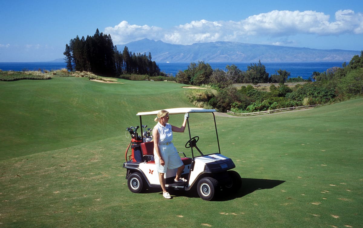
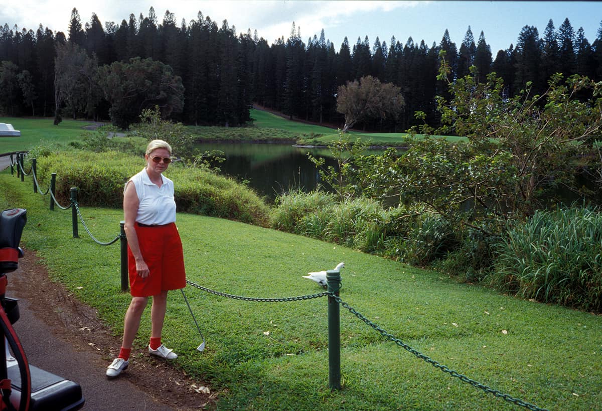
The third smallest of all the Hawaiian Islands is a true golfer’s paradise. The best resort hotels in Hawaii and two of the most beautiful golf courses in the world are located on the island of Lanai. Microsoft CEO Bill Gates is a regular guest at the Manele Bay Hotel and swings his golf clubs at The Challenge at Manele.

We have booked a flight from Oahu to the small island of Lanai and will spend the turn of the year here before we set off for the other islands of the Hawaiian archipelago. Already during the landing approach we see the bizarre beauty of this island, which only really opens up to you on a hike across the island.

The island of Lanai is also called the island of paradise. It is the smallest, but also the most exclusive of the developed islands of Hawaii. Until 1990, it was a pure pineapple island. In the meantime, two of the most exclusive hotels in all of Hawaii have been built. The Manele Bay Hotel is supposed to be our first accommodation. We arrive late in the evening and use the warm evening hours to eat on the terrace.

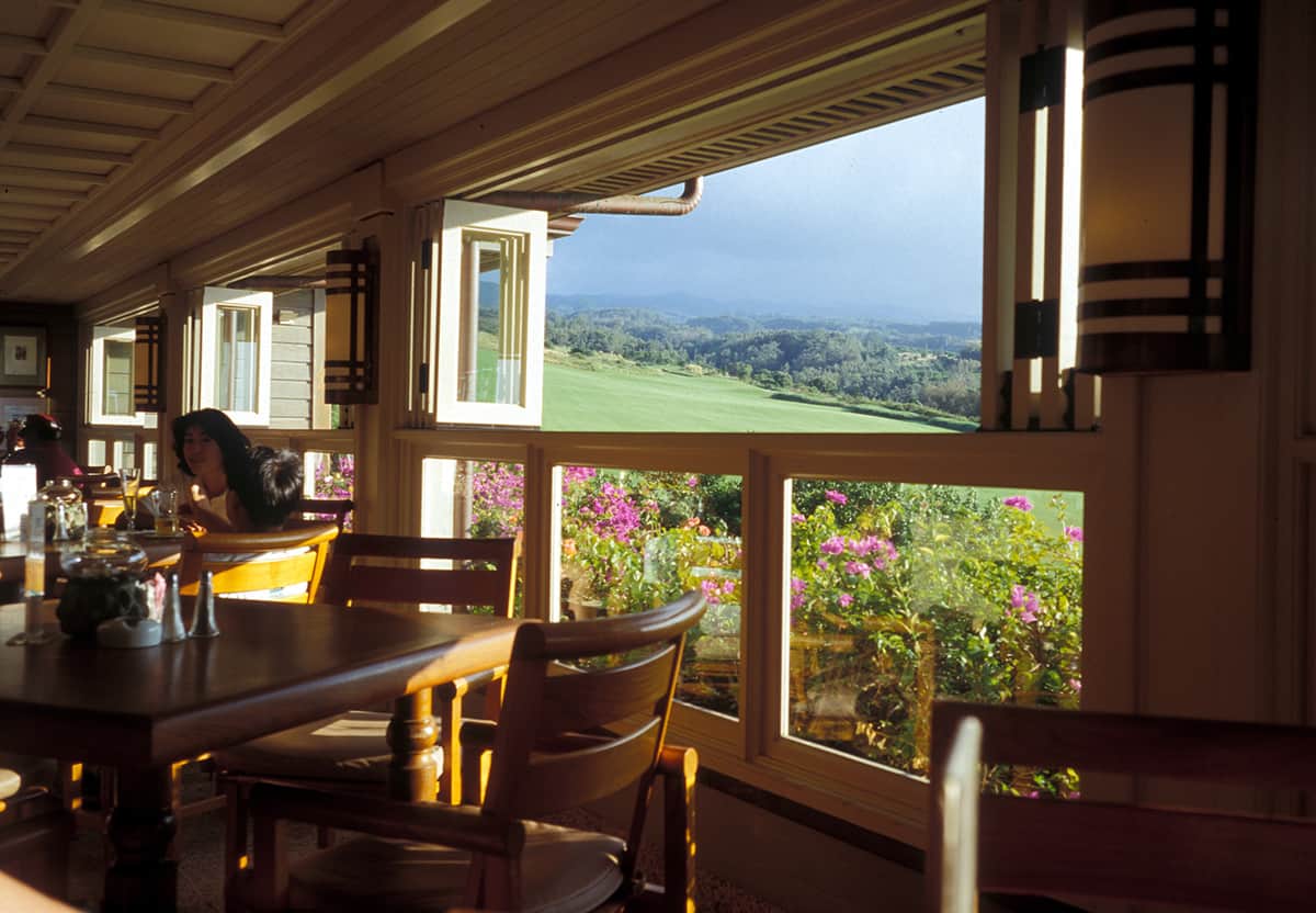
Lanai is only 29km long and 21km wide and has just under 50km of paved roads. The two luxury hotels have a total of only 350 rooms. The island has hardly any space for more visitors. If you want to discover paradise for a few days, this is the place for you. The island of Lanai is home to the largest pineapple plantation in the world. It belongs – like almost all of Lanai – to the Dole Pineapple Company. Lanai is a special “insider tip” with dreamlike, almost deserted beaches, hiking trails through a mountainous region rich in wildlife and a tiny, centrally located island capital at a cool 500 meters altitude. Lanai City is a sleepy place that hasn’t changed much in 100 years. The exclusive villas and suites of the Manele Bay Hotel are located on a dream beach. The view from the antique-laden lobby and pool is breathtaking.

The Experience at Koele, in the romantic forest and park landscape of the “Lodge at Koele”, was voted the best golf course in the USA. Pictures are available to see on our Lanai Golf Courses page. On the coast, white sandy beaches with rustling palm trees beckon.

Bumpy trails – only accessible with off-road vehicles – lead through the rugged but impressive hinterland. You can also take outback tours in Wrangler jeeps via the Munro Trail, a 12 km long trail through the mountains. Alternatively, the trail can of course also be hiked on foot. During the tour you have magnificent views over the small island and the sea. There is rarely a more beautiful beach than Polihua Beach on Lanai. Nowhere else is the sand so soft and the water so blue. Although the Garden of the Gods is only a few km away, few travelers get lost in the remote northwest of the island. Swimming is too dangerous at this point because of the strong current. A picnic is also one of the highlights of a stay at the lanai.

Pictures Hawaii – Lanai

Hawaii – Lanai
Hawaii – Lanai
Hawaii – Lanai
Hawaii – Lanai
Hawaii – Lanai
Hawaii – Lanai
Hawaii – Lanai
Hawaii – Lanai
Hawaii – Lanai
Hawaii – Lanai
Hawaii – Lanai
Hawaii – Lanai
Hawaii – Lanai
Hawaii – Lanai
Hawaii – Lanai
Hawaii – Lanai
Hawaii – Lanai
Hawaii – Lanai
Hawaii – Lanai
Hawaii – Lanai
Hawaii – Lanai
Hawaii – Lanai
Hawaii – Lanai
Hawaii – Lanai
Hawaii – Lanai
Hawaii – Lanai
Hawaii – Lanai
Hawaii – Lanai
Hawaii – Lanai
Hawaii – Lanai
Hawaii – Lanai
Hawaii – Lanai
Hawaii – Lanai
Hawaii – Lanai
Hawaii – Lanai
Hawaii – Lanai
Hawaii – Lanai
Hawaii – Lanai
Hawaii – Lanai
Hawaii – Lanai
Hawaii – Lanai
Hawaii – Lanai
Hawaii – Lanai
Hawaii – Lanai
Hawaii – Lanai
Hawaii – Lanai
Hawaii – Lanai
Hawaii – Lanai
Hawaii – Lanai
Hawaii – Lanai
Hawaii – Lanai
Hawaii – Lanai
Hawaii – Lanai
Hawaii – Lanai
Hawaii – Lanai
Hawaii – Lanai
Hawaii – Lanai
Hawaii – Lanai
Hawaii – Lanai
Hawaii – Lanai
Hawaii – Lanai
Hawaii – Lanai
Hawaii – Lanai
Hawaii – Lanai
Hawaii – Lanai
Hawaii – Lanai
Hawaii – Lanai
Hawaii – Lanai
Hawaii – Lanai
Hawaii – Lanai
Hawaii – Lanai
Hawaii – Lanai
Hawaii – Lanai
Hawaii – Lanai
Hawaii – Lanai
Hawaii – Lanai
Hawaii – Lanai
Hawaii – Lanai
Hawaii – Lanai
Hawaii – Lanai
Hawaii – Lanai
Hawaii – Lanai
Hawaii – Lanai
Hawaii – Lanai
Hawaii – Lanai
Hawaii – Lanai
Hawaii – Lanai
Hawaii – Lanai
Hawaii – Lanai
Hawaii – Lanai
Hawaii – Lanai
Hawaii – Lanai
Hawaii – Lanai
Hawaii – Lanai
Hawaii – Lanai
Hawaii – Lanai
Hawaii – Lanai
Hawaii – Lanai
Hawaii – Lanai
Hawaii – Lanai
Hawaii – Lanai
Hawaii – Lanai
Hawaii – Lanai
Hawaii – Lanai
Hawaii – Lanai
Hawaii – Lanai
Hawaii – Lanai
Hawaii – Lanai
Hawaii – Lanai
Hawaii – Lanai
Hawaii – Lanai
1 of 111

Questions about the destination Hawaii?

In the Oceania & South Seas forum you will get the answers!

12. July 2017 0 comments
0 FacebookTwitterPinterestEmail
Hawaii – Kauai – Ke’e Beach
Hawaii

Hawaii – Kauai – Ke’e Beach

by Joe OnTour 12. July 2017
written by Joe OnTour

Hawaii – Kauai – Ke’e Beach

From Princeville in the direction of Hanalei, you will pass Ke’e Beach on your way to the Na Pali Coast. This dreamlike stretch of coast is still completely preserved in its originality. No hotel buildings or the like disturb the South Sea idyll here.

Behind Hanalei, the road becomes narrower and more winding. It winds along the foot of the cliffs to the west and you can see the first foothills of the Na Pali cliffs. The vegetation here becomes denser and denser and we pass small, crooked wooden houses that are scattered along the way.

The houses are surrounded by tropical gardens where banana trees grow. On the way on, one white dream beach follows the next. Most of them are deserted.

The beach of Ke ́e Beach is lined with palm trees and the white foam crests that break on the offshore reef give rise to a real South Sea feeling. The shallow water here is ideal for snorkeling.

From here, the remains of old temples in the mountains can be visited on foot. From there you have a wonderful view of the surf-tossed coast. From Ke ́e Beach, the Kalalau Trail leads in steep windings up into the cliffs. In the undergrowth of the bushes grow pandanus trees, kukui trees, ti plants, wild ginger and all kinds of other colorful flowering plants. The path winds uphill and downhill and after about one kilometre you reach the first viewpoint, which offers an indescribable view of the surf below and the thousand-metre-high lava cliffs rising almost vertically into the sky. Truly an impressive experience.

A little further on you come to the Hanakapi’ai Valley. Here, erosion has carved a deep notch into the cliffs. The fine sandy beach invites you to take a break here. You can enjoy refreshment at the small river Hanakapi’ai. Freshwater fish live here, which in the course of evolution are able to climb up the stony waterfalls through suction cups on their fins. You can continue climbing on a narrow path to the Hanakapi’ai waterfalls. The trail is overgrown with dense mango and guava trees. Occasionally you can still see the remains of stone walls, which date back to earlier settlement times. It is 6.5 kilometers round trip to Hankapi’ai Valley. The tour can be done in about 3 hours. The entire trail is about 12 miles long. Depending on which side valleys you take, this can also take several days. Information about the condition of the trail and special features should be obtained from the State Department beforehand.

Pictures Hawaii – Kauai – Ke'e Beach

Hawaii – Kauai – Ke’e Beach

Questions about the destination Hawaii?

In the Oceania & South Seas forum you will get the answers!

12. July 2017 0 comments
0 FacebookTwitterPinterestEmail
Hawaii – Kauai – Hanalei
Hawaii

Hawaii – Kauai – Hanalei

by Joe OnTour 12. July 2017
written by Joe OnTour

Hawaii – Kauai – Hanalei

Kaua’i is also known as the Garden Island. No wonder, because it blooms and greens in all corners and ends of the island. Large parts of the island of Kauai are even still overgrown with primeval jungle. The small village of Hanalei is worth seeing, which has retained the charm and originality of the turn of the century to this day.

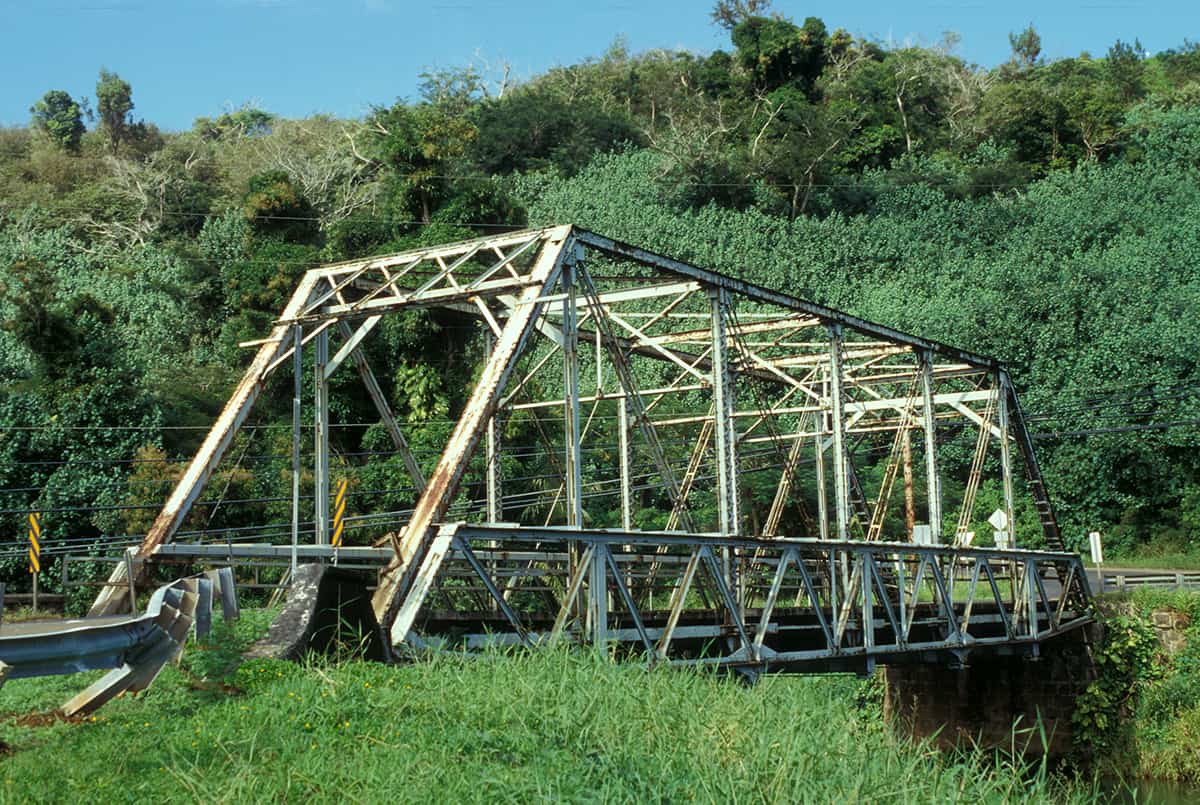
On the second day on the island, we first get a wheeled vehicle. To get in the mood, we chose a first route to Hanalei and on to Ke ́e Beach. The road ends there in a dead end and is not to be driven on, as the steep cliffs of the Na Pali Coast start from here. Shortly after Princeville, before the entrance to Hanalei, we cross an adventurously old single-track railway bridge from 1912. On the way to Hanalei you have a beautiful view of the Hanalei Valley on the left, which is characterized by dark green taro fields. Further away you can see the mountain ranges of the two volcanic mountains Waiáleále and Kawaikini, both of which are about the same height at 1570 meters above sea level. From there, the rained rich masses of water pour into the sea in several rivers, some of which are navigable.

Hanalei is a small dreamy village with mainly single-storey wooden houses, most of which are built on stilts. Time seems to have stood still here at the turn of the century. There is no hectic pace and everything goes smoothly. There are some shops for daily needs, a small post office and several restaurants. In addition to the local population, many temporary dropouts have settled here. The young audience and also the “young at heart” will find excellent conditions for all kinds of water sports in this quiet spot on earth. First and foremost, of course, is surfing. A little further behind the village of Hanalei towards Ha ́ena, another small village, the surf scene has fully established itself.

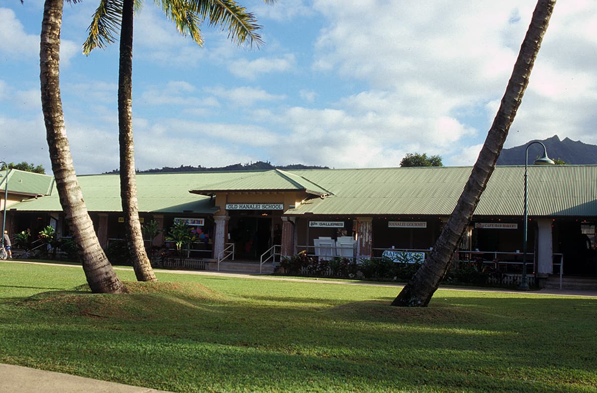
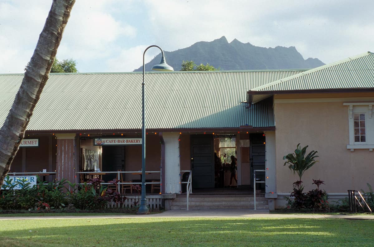
The Old Hanalai School with its integrated small shopping centre forms the centre of the village and characterises the streetscape with its striking, elongated building. There are also some shops for daily needs here. The semi-circular Hanalei Bay is bordered by a fine sandy white sand beach. Further west, it connects to Makahoa Point, behind which is Lumahai Beach.

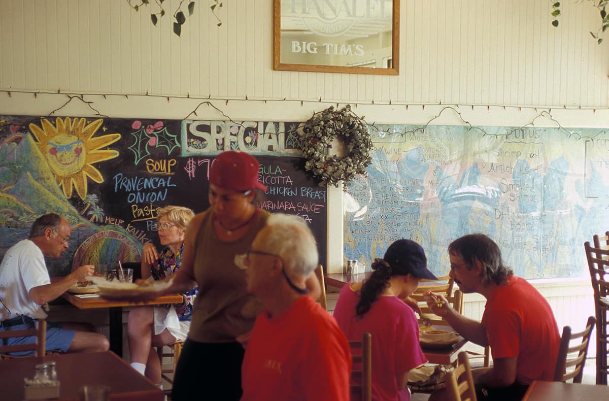
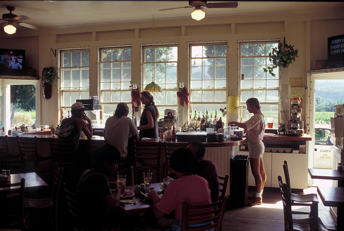
The film South Pacific was filmed here. In the 60s, many hippies settled in the neighboring valleys. A little of this can still be felt in Hanalei today. The 400 souls of the village, including many old hippies and artists, have successfully resisted to this day against replacing the old single-lane bridge at the entrance to the village with a new two-lane bridge. This means that the large coaches are denied access and mass tourism remains outside Hanalei. In this way, the inhabitants have preserved their own little South Sea paradise. After every hurricane, the crooked wooden huts are rebuilt and in their opinion it should stay that way. The old school building also houses the Hanalei Gourmet, a small café that serves good sandwiches, salads and soups. You immediately feel at home in the cozy atmosphere and the friendly service also contributes to this. The “old hippies” feel just as comfortable here as the artists of the village and the surfer scene. One or the other traveler or golfer from Princeville can also be found. Overall, however, there are very few tourists to be found, probably due to the circumstances described above.

In the months from December to April, boat trips for whale watching can be made from Hanalei. You can also watch the whales from Kee Beach. A special view has been set up here, the Laka’s Hula platform, which is located 3o meters above the beach park. With a little luck you can see the common humpback whales. In the town of Hanalai, splashy 4-hour inflatable boat tours along the Na Pali coast are offered. In the winter months, however, these are only recommended in calm weather. A special experience are the helicopter tours around the Na Pali Coast, which start from the airfield near Princeville and last between 30 and 60 minutes. We report on this on our separate page “Na Pali Coast”. Worth a visit is the Wai ́oli Mission House, a small museum that can be found directly behind the green-painted mission church. The house was built in 1837 by the missionary couple Alexander in the New England style. It is equipped with original furniture from the Wilhelminian period and gives an idea of the lifestyle of the time.

The landscape around Hanalei has probably remained unchanged for generations. Taro has been cultivated in the Valley since time immemorial. Taro is a Polynesian natural plant and was introduced and cultivated by the first immigrants from the Maquesas Islands. The plant is very rich in vitamins and has a high mineral content. The red tubers of the taro root are crushed and mixed into a pulp, the poi. The whole tastes quite bland, but has been proven to be extremely healthy and is even recommended for allergy sufferers. The entire alluvial area of the Hanalei River is a refuge for wildlife. The many water birds as well as herons and ducks, which have been placed under nature conservation, cavort here. The small cheeky cardinal birds with their red heads have become cultural followers and lurk at the tables for falling breadcrumbs.

Pictures Hawaii – Kauai – Hanalei

Hawaii – Kauai – Hanalei

Questions about the destination Hawaii?

In the Oceania & South Seas forum you will get the answers!

12. July 2017 0 comments
0 FacebookTwitterPinterestEmail
Hawaii – Kauai – Na Pali Coast
Hawaii

Hawaii – Kauai – Na Pali Coast

by Joe OnTour 12. July 2017
written by Joe OnTour

Hawaii – Kauai – Na Pali Coast

The Na Pali Coast is a stretch of coast in the north of the island of Kauai. The picturesquely rugged rocky coast begins just behind Haena at Kee Beach and runs from here in a westerly direction. This stretch of coast is not developed, i.e. there is no road past it that can be used. There are several options for visiting the coast. You can hike to it, rent a helicopter and get a brief overview of this coastal region in a one-hour sightseeing flight, or approach it from the sea side by boat. Which of the options is chosen also depends on the condition and the time available to the visitor.

We first visited from the air and then hiked the Na Pali Coast experience up close. In any case, both options are recommended, although in our opinion the more lasting impression can be gained by the slower way (on foot). If you have some stamina, you should not miss this up-close “experience”. We have described the hike on the Kalalau Trail, which lasted several hours, in more detail on another page. The approximately one-hour scenic flight takes you over Waimea Canyon and then along the Na Pali Coast. There are a sufficiently large number of airlines that offer these flights. The helicopters take off from all three airports, Port Allen in the south, Lihue on the east coast and Princeville Airport in the north. The costs are between 80 and 100 US$ p.p.

We took off from Princeville Airport with Papillon Hawaiian helicopters (Tel. 826 6591).

In addition to the pilot, there is room for four other passengers in the helicopter. One in the front next to the pilot and three other passengers in the back seats. Everyone receives a set of headphones with a microphone, so that good communication is possible during the flight.

The view of the mountain range off the Na Pali Coast is impressive. Waimea Canyon can be seen from the air in all its dimensions.

The side of the Na Pali Coast facing away from the sea is very rugged. View of Waimea Canyon from a helicopter perspective. Our pilot pulls the helicopter in a climb over the Na Pali cliffs.

On the return flight, the bizarre courses of the mountain ranges with their volcanic origin are clearly visible. Inland, we fly over one of the many waterfalls.

The Na Pali Coast is a stretch of coast in the north of the island of Kauai. The picturesquely rugged rocky coast begins just behind Haena at Kee Beach and runs from here in a westerly direction. This stretch of coast is not developed, i.e. there is no road past it that can be used. There are several options for visiting the coast. You can hike to it, rent a helicopter and get a brief overview of this coastal region in a one-hour sightseeing flight, or approach it from the sea side by boat. Which of the options is chosen also depends on the condition and the time available to the visitor.

We first visited from the air and then hiked the Na Pali Coast experience up close. In any case, both options are recommended, although in our opinion the more lasting impression can be gained by the slower way (on foot). If you have some stamina, you should not miss this up-close “experience”. We have described the hike on the Kalalau Trail, which lasted several hours, in more detail on another page. The approximately one-hour scenic flight takes you over Waimea Canyon and then along the Na Pali Coast. There are a sufficiently large number of airlines that offer these flights. The helicopters take off from all three airports, Port Allen in the south, Lihue on the east coast and Princeville Airport in the north. The costs are between 80 and 100 US$ p.p.

The Waimea Canyon with its foothills into the green tropical forest on the Na Pali cliffs with a view into the interior, all seen from a helicopter perspective.

On the pictures above we can admire the view during the helicopter approach to the Na Pali coast.

The ridges and foothills of the Na Pali cliffs are impressive from a helicopter perspective. The Na Pali cliffs rise steeply from the sea.

From a bird’s eye view, Kee Beach and the Na Pali cliffs form a magnificent natural backdrop, which is probably unique in the world in its uniqueness.

A twin-engine plane is landing in front of us and we have to wait until it is rolled out. The flight is an experience not to be missed. The magnificent landscape will be remembered for a long time.

Pictures Hawaii – Kauai – Na Pali Coast

Hawaii – Kauai – Na Pali Coast

Questions about the destination Hawaii?

In the Oceania & South Seas forum you will get the answers!

12. July 2017 0 comments
0 FacebookTwitterPinterestEmail
Hawaii – Kauai – Strände
Currently PopularHawaii

Hawaii – Kauai – Beaches

by Joe OnTour 12. July 2017
written by Joe OnTour

Hawaii – Kauai – Beaches

We have recorded a small selection of beaches and coastal regions of the island of Kaua’i here. To list all beaches would go beyond the scope of this page, as there are so many small and smallest natural and still undeveloped beaches on Kaua’i. Kumukumu Beach (also called Donkey Beach) on the east coast is generally considered the most beautiful beach on Kaua’i, but we don’t think you can call it the most beautiful beach, as we think that each part of the island has its own specific charms. The beaches of Kaua’i stretch around the island like a string of pearls. Most of them are not signposted and simply have to be asked or searched for. Most interesting we found the crescent-shaped small bays, which are off the main roads. In general, it can be said that the beaches in the north of the island are less populated. Often you are even the only visitor. Where the large hotels and condominiums are concentrated, the beaches are already more frequented.

The famous beach at Ke’e Beach is particularly impressive. The photos can only reproduce a short and incomplete snapshot. Sitting there on the beach and breathing in the salty air of the sea and feeling the sound of the surf is an irretrievable sensory experience.

The beach at Hanalei (above) is as unreal as the entire scenery from a dream seems to be. It is not for nothing that this is the dropout paradise of the hippies of the sixties and seventies.

Ke’e Beach is located in the north of the island in Haena State Park and can be found at the end of Road No. 560. This is where the Na Pali Trail begins, which runs along the coast. To the west, the up to 1000-meter-high cliffs of the Na Pali Coast rise up.

Below is a house near Hanalei. Typical is the design that is open at the bottom. Here, in the “basement” on the ground floor, space was created for a shady place for the car and for the boat.

On the first floor you live (with a surrounding terrace) and on the 2nd floor are the bedrooms. The whole thing is of course framed by palm trees and banana trees. The beach is 50 meters away. For many, however, this remains a dream, as the prices for building land in this region are simply no longer affordable.

Kilauea Point is the northernmost point of the island of Kaua’i and is guarded by a lighthouse built in 1913. The small headland became a reserve for seabirds.

Pictures Hawaii – Kauai – Beaches

Hawaii – Kauai – Strände

Questions about the destination Hawaii?

In the Oceania & South Seas forum you will get the answers!

12. July 2017 0 comments
0 FacebookTwitterPinterestEmail
Hawaii – Kauai
Hawaii

Hawaii – Kauai

by Joe OnTour 12. July 2017
written by Joe OnTour

Hawaii – Kauai

Kaua’i is also known as the “Garden Island” due to its extremely lush vegetation. The island offers one of the most spectacular and pristine landscapes in the archipelago. There are still impassable jungle areas here that are completely undeveloped.

The island has desert-like plains, deep gorges and cliffs that rise up to 1000 meters from the sea. In general, Kaua’i is full of superlatives. Here you will find the most beautiful beaches, the most lush tropical flora and the largest coral reefs of the archipelago. Kaua’i is located at the northwestern end of the island chain. Erosion has created dramatic cliffs on the north coast. Huge canyons have formed inland. At the 1500-metre-high Wai’ale’ale, the trade winds are caught and discharge their water masses with 12 metres of precipitation per year. The soft volcanic rock is washed out by these masses of water into bizarre formations. We had the feeling that Kaua’i has the lowest number of tourists. There is still a lot of original information to learn here. This is probably also due to the fact that the island is often hit by tropical cyclones, which apparently deters investors from building more hotel complexes. In 1992, Hurricane “Iniki” razed large parts of the holiday centers to the ground and destroyed 10,000 houses. Strangely enough, nature recovered quickly, because just one year later the damage was hardly visible. Kaua’i is one of the few islands that cannot be completely circumnavigated by car, as the entire area around the Na Pali Coast does not offer any passage.

After a short flight with a twin-engine propeller plane, we land at Princeville Airport in the north of the island. The runway is just enough for the prop planes and the small building for handling at the edge of the runway already conveys a South Seas feeling. We haven’t pre-ordered a rental car yet and have to organize a taxi first. The drive to the Sheraton Princeville Hotel, which has already been pre-booked, takes ten minutes.

Located on Hanalei Bay, it has recently been completely restored. The entrance is dominated by an impressive huge lobby with a fantastic panoramic view of the bay and the neighboring Na Pali Coast. It is said that this is arguably the best location in all of Hawaii. The ambience is dignified and modern. The reception hall is furnished with antique furniture from the 18th and 19th centuries.

Of course, the hotel has all conceivable amenities such as swimming pool, sauna, fitness center, several restaurants etc. It is located directly on the fine sandy beach. We have booked our base a week in advance and want to explore the island from here. The hotel is not completely booked despite the Christmas and New Year season and so we get an extra large room with a view of the Na Pali coast after a long and tough negotiation. Brigitte is thrilled. The bathroom has a panoramic window, so that you can enjoy the view of the Na Pali coast while bathing.

But now enough of so much enthusiasm, after all, we want to discover the island of Kauai with its many secrets. However, the self-imposed and completely voluntary program is not scheduled until the next morning and so we end the evening comfortably with a glass of wine with a view of the typical Hawaiian sunset. It is a beautiful spectacle when the huge fireball of the sun sinks into the sea and illuminates the Bali-Hai rocks of the Na Pali Coast golden.

Photos Hawaii – Kauai

Hawaii – Kauai
Hawaii – Kauai
Hawaii – Kauai
Hawaii – Kauai
Hawaii – Kauai
Hawaii – Kauai
Hawaii – Kauai
Hawaii – Kauai
Hawaii – Kauai
Hawaii – Kauai
Hawaii – Kauai
Hawaii – Kauai
Hawaii – Kauai
Hawaii – Kauai
Hawaii – Kauai
Hawaii – Kauai

Questions about the destination Hawaii?

In the Oceania & South Seas forum you will get the answers!

12. July 2017 0 comments
0 FacebookTwitterPinterestEmail
Hawaii – Maui
Hawaii

Hawaii – Maui

by Joe OnTour 12. July 2017
written by Joe OnTour

Hawaii – Maui

Maui is the second largest island in the Hawaiian archipelago. Maui is divided by a wide valley into two unequal halves, each surmounted by an extinct volcano. Maui has an area of 1888 square kilometers (for comparison, Saarland with 2573 square kilometers) and is inhabited by 106,000 people. The main city and seat of the county government is Wailuku. Its varied landscape is characterized by golden beaches, wooded mountain ranges with bizarre rocks, grasslands and wide plains. The highest elevation is the 3,055-meter-high, dormant volcano Haleakala.

The average daily temperatures are between 21° and 25° C; the amount of precipitation varies from place to place. The island got its name from Maui, a demigod from ancient Hawaiian mythology. Maui’s deeds are handed down in historical songs. Legend has it that Maui pulled the islands of the Hawaiian archipelago out of the Pacific with a giant fish hook.

The island has a multifaceted settler history. When Kamehameha I united all the Hawaiian Islands in his empire, he made Lahaina on Maui his capital in 1802. Missionaries and whalers arrived here soon after, dividing the island into two camps. The end of the whalers came with the US Civil War of 1860 and the rise of the petroleum industry. A large part of Maui’s arable land was planted with sugar cane, and workers were brought in from Asia. The island developed into a peaceful agricultural area with a special charm and rustic beauty. The booming tourism ensured that nowadays visitors can experience the charm of the island in many ways.

The smaller West Maui offers very well-maintained tourist facilities in terms of style and quality. This is also where the sleepy capital and the former whaling station Lahaina with the biggest attraction, the floating whaling museum in the harbor, is located. We think Maui’s landscape is the most “Hawaiian” of the entire island world. In addition, the beaches here are the most beautiful in the whole archipelago. Maui is home to a wide variety of landscapes, from rocky sandy coves to beautiful valleys with rushing waterfalls to rainforests and lush plantations. Everything that is tropical plants and fruits seems to thrive here. Above the whole scenery rises the mighty volcano Haleakala (3057 m) with its cooled craters. Herds of cattle graze on its slopes. The huge crater landscape can be hiked on foot or on horseback.

If you stay in a cabin at the top or drive up the winding road to the summit early in the morning, you can experience a Hollywood-style sunrise. The volcanic landscape with its unique ecosystem has extensive rainforests, deep gorges and rare birds. The center of the park is the 4 kilometer wide and 12 kilometer long Haleakala Crater.

One of the most beautiful places on Maui is Wailua. Below the Wailua Falls, the clear water flows through seven pools (“Seven Pools”) and then pours into the open sea. This is also a pleasant bathing area. Maui is the cheapest place in Hawaii for whale watching tours. Every year from November to April, humpback whales gather in the warm waters off the coast. The adult animals grow to a length of more than 13 meters and weigh more than 40 tons.

Today, the Iao Valley is a charming nature park in the rainforest, but once a battle site during the conquest of Maui by Kamehameha I. The Ahihi-Kinau Natural Area Reserve is also worth seeing. Particularly impressive is a tour along the charming coastal road to Hana Valley. The Oheo Stream and the Seven Pools with their natural rock pool and clear water are also worth a visit. For those interested in botany, the Helani Gardens botanical garden is well worth seeing, while the Kepaniwai Heritage Garden is dedicated to the cultures of the Hawaiian people. Lahaina is a lively, picturesque town with museums and historic sites, shops, cafes and art galleries.

Other tranquil provincial towns are the artists’ colonies of Makawao, Ha iku and Kula on the slopes of Haleakala. Attractive for sporty enthusiasts are the beaches off Molokini (for snorkeling), Paia Beach (a world-class windsurfing area) and Hookipa Beach (windsurfing).

Photos Hawaii – Maui

Hawaii – Maui
Hawaii – Maui
Hawaii – Maui
Hawaii – Maui
Hawaii – Maui
Hawaii – Maui
Hawaii – Maui
Hawaii – Maui
1994 12 384
1994 12 383
1994 12 382
Hawaii – Maui
Hawaii – Maui
Hawaii – Maui
Hawaii – Maui
Hawaii – Maui
Hawaii – Maui
Hawaii – Maui
Hawaii – Maui
Hawaii – Maui
Hawaii – Maui
Hawaii – Maui
Hawaii – Maui
Hawaii – Maui
Hawaii – Maui
Hawaii – Maui
Hawaii – Maui
Hawaii – Maui
Hawaii – Maui
Hawaii – Maui
Hawaii – Maui
Hawaii – Maui
Hawaii – Maui
Hawaii – Maui
Hawaii – Maui
Hawaii – Maui
Hawaii – Maui
Hawaii – Maui
Hawaii – Maui
Hawaii – Maui
Hawaii – Maui
Hawaii – Maui
Hawaii – Maui
Hawaii – Maui
Hawaii – Maui
Hawaii – Maui
Hawaii – Maui
Hawaii – Maui
Hawaii – Maui
Hawaii – Maui
Hawaii – Maui
Hawaii – Maui
Hawaii – Maui
Hawaii – Maui
Hawaii – Maui
Hawaii – Maui
Hawaii – Maui
Hawaii – Maui
Hawaii – Maui
Hawaii – Maui
Hawaii – Maui
Hawaii – Maui
Hawaii – Maui
Hawaii – Maui
Hawaii – Maui
Hawaii – Maui
Hawaii – Maui
Hawaii – Maui
Hawaii – Maui
Hawaii – Maui
Hawaii – Maui
Hawaii – Maui
Hawaii – Maui
Hawaii – Maui
Hawaii – Maui
Hawaii – Maui
Hawaii – Maui
Hawaii – Maui
Hawaii – Maui
Hawaii – Maui
1 of 80

Questions about the destination Hawaii?

In the Oceania & South Seas forum you will get the answers!

12. July 2017 0 comments
0 FacebookTwitterPinterestEmail
Hawaii Big Island
Hawaii

Hawaii – Big Island

by Joe OnTour 12. July 2017
written by Joe OnTour

Hawaii – Big Island

The island of Hawaii bears the same name as the state of Hawaii. So a second name had to be found to distinguish it. In common parlance, the name Big Island has therefore prevailed. Big Island is the largest island in the archipelago. In terms of area, all other islands would fit in here.

Nevertheless, the Big Island is geologically the youngest of the islands. In the southern part of the island, volcanic activity is constantly creating new land. The vast lava deserts create interesting extremes in the landscape, as soon as you leave these areas, you will be surprised by tropical rainforests, green pastureland, steep cliffs and rugged mountains. James Cook, the discoverer of Hawaii, landed here and also died on the island. Today, Hawaii is home to a wide variety of population groups. They are made up of the Paniolos (of Spanish descent), who live as cowboys on the island’s largest cattle ranch, wealthy Americans and landowners, as well as Hawaiian fishermen and sugar cane farmers. In addition, many conveyors and environmentalists have settled on the island. On the highest mountain, Mauna Kea with its 4200 meters above sea level, researchers from various countries live who are testing alternative forms of energy. Many athletes travel to Hawaii to practice water sports, golf, sports and deep-sea fishing. The Ironman competition is also held here every year. In winter, skiing is even possible on Mauna Kea. Many luxury resorts and golf courses have settled on the island. In addition, there are also cheap accommodations that offer bed and breakfast. There is something for every taste and budget.

After a short flight from Honolulu we arrive at Hilo Airport on the island of Hawaii (Big Island). It is recommended to book a rental car in advance during the high season.

We are lucky with the weather, because the Hilo Coast (East Coast) is one of the wettest places in America. Rain falls here 270 days a year. The high volcanoes practically form two weather zones, the aforementioned humid Hilo Coast and the desert-dry Kona Coast in the west of the country. The approximately 120,000 inhabitants of the Big Island receive around 800,000 visitors per year. However, the development of tourism is declining. The large hotel resorts were mainly built in the 70s and 80s. The island of Hawaii was therefore largely spared from further major construction activity in the 90s. To explore the Big Island, a rental car is practically unavoidable. We have chosen a white Oldsmobile, which we get after a long negotiation instead of a Japanese small car at no extra charge. The island of Hawaii was therefore largely spared from further major construction activity in the 90s. To explore the Big Island, a rental car is practically unavoidable.

We have chosen a white Oldsmobile, which we get after a long negotiation instead of a Japanese small car at no extra charge. The employee of the rental company was cooperative in solving the problem with the long legs. The first impression we get of the incredible lava masses is simply overwhelming. The lava flows stop at nothing. They roll over the asphalt roads with meter-high lava mountains, so that the roads have to be relocated. The residents have become accustomed to the forces of nature in Hawaii and accept what is happening with a pronounced serenity. Where the lava flows pour into the sea, the environment looks like a lunar landscape. Only gradually does isolated plant growth form, which takes possession of the newly created territory. In this way, the cycle of dying and living closes, which can be traced here up close. We have a “short” way of about 100 kilometers to our hotel on the Kohala Coast.

The Ritz Carlton Mauna Lani is the island’s newest hotel and is located on the small and sheltered Pauoa Bay. The journey takes us along the east coast. Highway 19 is well developed and so the drive north goes past sugar cane fields and orchards. The summit of Mauna Kea is covered in thick clouds. So we drive past the sleepy western village of Honomu. The place is characterized by weathered wooden houses. Worth seeing here are the Akaka Falls in the state park of the same name. They are considered one of the most beautiful waterfalls on the island. A circular path leads through a tropical rainforest to the 135-meter-high waterfall. Until Honaka’a we pass a whole series of small and very small villages. Honaka’a is the largest city on the Hamakua Coast with its approximately 2000 inhabitants. The inhabitants here live mainly from sugar cane cultivation, agriculture and the cultivation of macadamia nuts. From Honaka’a, the trail now heads west along Hwy 19 through Kohala Mountain.

We come to the highlands of the island. Here we are greeted by a foggy drizzle that does not even penetrate the sun. But as soon as we have driven through the mountains, it gets drier and the sun burns from the sky again. The highway runs along the Kohala Coast through endless lava fields. It seems as if the hotels far away from the roads on the coast have been neatly separated from each other by the large lava flows. Each of the hotels located here has its own access road, which always leads directly past the lava fields.

Finally we have reached the hotel. The Ritz Carlton is the most European of all the hotels on the Big Island and is characterized by a simple, elegant style, while neighboring hotels such as the Hyatt seem overloaded and pompous by European standards. The interior of the halls and rooms is decorated with art objects from the 18th century. The rooms are extremely large (50 – 60 sqm) and tastefully furnished. All rooms have a view directly to the sea. The hotel has 2 top golf courses attached to it, which we describe in more detail on our “Golf Courses” page.

There is a small fine sandy beach at the hotel, but also the dark beach shaped by lava a few meters away. Some of the golf courses have been built directly into the lava fields. This results in an abstractly interesting design of the squares. The courses are not easy to play, as you always have to fight either with solidified lava flows or with the nearby water of the sea. But more about this on our separate page for golf enthusiasts.

A trio consisting of two guitarists and a singer conveys to us the original Hawaiian folklore, which is still cultivated on the large ranches of the island. They move from guest to guest, so to speak, and so we can find out in a conversation with them that they work in real life on a ranch in the plateau of the island. In your free time, you will be hired by the hotels from time to time and thus improve your salary. In their original national costumes, their depictions are an experience for the eyes and ears. After a long, eventful day, it’s time for a well-deserved siesta on the beach. Jürgen has chosen a shady spot in the hammock and dreams of many more days and adventures in Hawaii. We will not only report on his dreams on the following pages.

Pictures Hawaii – Big Island

Hawaii Big Island
Hawaii Big Island
Hawaii Big Island
Hawaii Big Island
Hawaii Big Island
Hawaii Big Island
Hawaii Big Island
Hawaii Big Island
Hawaii Big Island
Hawaii Big Island
Hawaii Big Island
Hawaii Big Island
Hawaii Big Island
Hawaii Big Island
Hawaii Big Island
Hawaii Big Island
Hawaii Big Island
Hawaii Big Island
Hawaii Big Island
Hawaii Big Island
Hawaii Big Island
Hawaii Big Island
Hawaii Big Island
Hawaii Big Island
Hawaii Big Island
Hawaii Big Island
Hawaii Big Island
Hawaii Big Island
Hawaii Big Island
Hawaii Big Island
Hawaii Big Island
Hawaii Big Island
Hawaii Big Island
Hawaii Big Island
Hawaii Big Island
Hawaii Big Island
Hawaii Big Island
Hawaii Big Island
Hawaii Big Island
Hawaii Big Island
Hawaii Big Island
Hawaii Big Island

Questions about the destination Hawaii?

In the Oceania & South Seas forum you will get the answers!

12. July 2017 0 comments
0 FacebookTwitterPinterestEmail
Hawaii – Oahu
City tripsHawaii

Hawaii – Oahu

by Joe OnTour 12. July 2017
written by Joe OnTour

Hawaii – Oahu

Oahu is the third largest island in the archipelago. The capital Honolulu is a lively modern metropolis with about 400,000 inhabitants. As many as 800,000 people live in the entire catchment area. The city is located on the south coast of the island and is the first port of call for most tourists. Map of the island of Oahu – HawaiiFor many, it remains the only one, because they spend their entire vacation in one of the approximately 30,000 hotel rooms of Waikiki, the glamorous seaside resort of Honolulu. The white sandy beach stretches in a crescent shape from the marina to Diamond Head Crater, the city’s landmark. You always feel a light cooling breeze from the sea and are enchanted by the crystal-clear, turquoise water on which the colourful catamarans sail. For many, this is the dream of a holiday par excellence. However, we have decided to explore the islands away from the usual tourist flow. Once again, this is associated with a lot of effort and time, as the neighboring islands can only be reached by the regional small planes. But more about that later and on the following pages. Here we want to report on Oahu first.

The plane tickets say “HNL” and so we end up at Honolulu International Airport. At night, we float over the city, which almost gives the impression of an American city with its many lights. We are a bit disappointed. For acclimatization, we rented a few days in the Pink Lady of Waikiki, the Royal Hawaiian. The hotel is located directly on the beach. Supposedly, it is the most famous hotel in town, but at least it is a plush dream in pink. Here is the address: 2259 Kalakaua Ave., Honolulu, HI 96815, Tel. 923-7311. On Waikiki Beach, one large hotel follows the other.

The next morning everything looks a little different. Rested and spoiled with a proper breakfast, we have recovered from the stress of flying and now want to explore the city and the neighboring beaches. The weather is also kind to us. The Waikiki beach is extremely well visited. The audience seems to consist mainly of Americans and Japanese. We think it’s too good to spend the time sunbathing and so we get a rental car for the first exploration tour and decide to explore downtown and the immediately neighboring beaches. As soon as you leave the main beach Waikiki Beach, you get a first impression of the once original Hawaii. A few miles from Waikiki, the beaches are almost deserted. The water on the beaches is crystal clear and shimmers light blue, green and turquoise. The light breeze from the open sea provides a pleasant cooling. We are once again reconciled by nature and at the same time attuned to further hopefully positive experiences. Waikiki and Honolulu are located on the south shore of the island of Oahu. Here is the dry, sunny side of the island. The forest of hotel towers extends to the east to Kapi’olani Park. Behind it rises the Diamond Head crater. This is Waikiki’s landmark.

At noon we are back in Honolulu. The streets are hectic, noisy and animated by a colorful mixture of peoples. We find many small Asian shops in Chinatown, which invite us to stroll and shop. The Chinese have been living here since 1850 and have founded their very own district. Once again, we are fascinated by this colorful, lively life. There is always something new to discover and explore.

Exotic fruits are offered on King Street and small food stalls on the street take care of the physical well-being. The scent from the bubbling pots fills the air. In a small shop we find strange concoctions that the owner offers us to alleviate all kinds of ailments. On Maunakea Street, wreaths of colorful flowers woven by women are offered for sale. Everything here is a strange mixture of nostalgia, kitsch and commerce. The colourful mixture of Chinese, Filipinos, American tourists in brightly coloured holiday dresses, Japanese in business and burly Hawaiian mammies in flowing mu’umu’us makes a decisive contribution to this. The Waikiki trolleys invite you to go sightseeing. You can get on and off at many stations and take a look at the most important sights at your leisure. We decide to pay a visit to the historic harbor “Pearl Harbor”. With its narrow entrance and many lagoons, the pearl harbor is the best natural harbor in the entire Hawaiian archipelago.

Since the American-Spanish War of 1898, this has been the most important war port in the Pacific region. He became famous on December 7, 1941 for the surprise Japanese attack in which the harbor was bombed and as a result of which President Roosevelt ordered the entry into the Second World War. A total of 2300 American soldiers died here. The attack lasted only two hours in total, with 1,100 people losing their lives on the battleship “U S S Arizona” alone. The wreck of the ship was declared the USS Arizona Memorial. The memorial is located on Battleship Row directly in the harbor area. The USS Bowfin is moored, also moored directly at the harbor for inspection. We meet an over 70-year-old veteran in the Visitor Center, who does his voluntary service here as a ranger and willingly provides information about the events of that time. He tells of the flaming chaos and the hail of bombs and how the comrades run on deck without clothes and die miserably in the inferno of exploding bombs and ammunition chambers. For Americans, this memorial is a compulsory exercise and the center is correspondingly heavily frequented. But the Japanese also visit this site and they ask us to take a group picture of them in front of the “USS Bowfin”. They have no sensitivities here, after all, they own half of Hawaii today. Memorial plaques and relics of modern times are united at the harbour.

Disused rockets from the early days of space travel are also on display at the port. In the evening we enjoy the sunset on Magic Island. Directly on the beach, a trio plays in the hotel garden. A quarter of an hour after sunset the sky shines in a warm, fiery red reflection. The setting sun casts its rays with its last strength against the slowly passing clouds and makes them glow into a natural fireworks display. The approaching darkness is replaced by the approaching lights of the surrounding hotel complexes and the boats illuminated on the sea.

People are gearing up for the nightly show. We also want to enjoy a little bit of this very special atmosphere, especially since our jet lag is slowly dissipating. A large wedding celebration is currently being held in the neighboring hotel garden. For many Japanese, the wedding celebration in the Hawaiian Islands is one of the most important experiences in their lives. Accordingly, these celebrations are lavishly equipped. The entire family clan is invited and sometimes consists of hundreds of guests. It is not uncommon for the family’s entire savings to be sacrificed for this ceremony. After the hustle and bustle of the day, we enjoy the natural spectacle of the fantastic sunset with a glass of wine.

Now we have some time to organize our thoughts and make plans for the next day. A day with many new impressions is coming to an end. We are excited to see what awaits us tomorrow.

Photos Hawaii – Oahu

Hawaii – Oahu
Hawaii – Oahu
Hawaii – Oahu
Hawaii – Oahu
Hawaii – Oahu
Hawaii – Oahu
Hawaii – Oahu
Hawaii – Oahu
Hawaii – Oahu
Hawaii – Oahu
Hawaii – Oahu
Hawaii – Oahu
Hawaii – Oahu
Hawaii – Oahu
Hawaii – Oahu
Hawaii – Oahu
Hawaii – Oahu
Hawaii – Oahu
Hawaii – Oahu
Hawaii – Oahu
Hawaii – Oahu
Hawaii – Oahu
Hawaii – Oahu

Questions about the destination Hawaii?

In the Oceania & South Seas forum you will get the answers!

12. July 2017 0 comments
0 FacebookTwitterPinterestEmail
Egypt - General information
EgyptGeneral country information

Egypt – General info

by Joe OnTour 12. July 2017
written by Joe OnTour

Egypt – General information

Location: Northeast Africa

Area: 1,001,450 km² (or about 995,450 km² pure land area without inland waters, depending on the source)

Population: around 115 to 118 million (as of 2026) – significantly more than the previously mentioned 71.2 million (as of 2006); Egypt is now the most populous country in the Arab world and the third most populous country in Africa.

Population density: around 115–120 inhabitants per km² (based on the total area; since around 95% of the population lives in the narrow habitable strip of the Nile, the actual density there is many times higher).

Capital: Cairo (El Kahira) – Population today around 10 million in the core city, around 21–22 million in the greater Cairo/Giza area – making it by far the largest city in Africa and the Arab world (instead of the previously mentioned 7.8 million in 2006).

New administrative capital: Since 2015, Egypt has been building a completely new capital (officially “New Administrative Capital”) about 60 km east of Cairo, to which government agencies and ministries have been gradually moving since 2023. The aim is to reduce the enormous population pressure on Cairo; however, the new city has so far grown much more slowly than planned. Cairo will remain the economic, cultural and traveler-relevant center of the country for the foreseeable future.

Form of government: Presidential republic since 1953. Current constitution of 2014 (with amendments in 2019, including extension of terms of office); the emergency laws that had previously been in force since 1981 were officially repealed in 2021, but some of their powers were transferred to regular laws. Bicameral parliament (House of Representatives and the Senate, which was reintroduced in 2020). Independent since 1922 (former British protectorate).

Current president: Abdel Fattah al-Sisi, in office since June 2014 (potentially re-electable until 2030 due to a constitutional amendment in 2019).

Geography: Egypt borders the Mediterranean Sea in the north, Sudan in the south, Libya in the west and the Red Sea and Israel in the east. The Nile Delta is located in Lower Egypt, the Nile Valley in Upper Egypt. East of the Suez Canal lies the Sinai Peninsula. The vast majority of the population still lives in the agricultural Nile delta and valley; oases are the only remnants of the once fertile lowlands off the Nile. The narrow coastal regions on the Mediterranean Sea and on the African side of the Red Sea are also densely populated or developed for tourism. The Aswan Dam continues to regulate the Nile flooding, which used to recur annually.

Language: The official language is Arabic. English is now much more commonly used in tourism and business than French, which has lost its importance.

Religion: around 90% of the inhabitants are Muslims (almost exclusively Sunnis), around 10% belong to Christian minorities, mainly from the Coptic Orthodox Church.

Local time: CET + 1 (GMT+2). Egypt had abolished daylight saving time in the meantime and reintroduced it for a few months in 2023 on a trial basis; since then, a uniform time without change has been in place again all year round – travelers should check the exact current regulation shortly before departure, as it has been changed several times in recent years.

Mains voltage: 220 V, 50 Hz. In some rural areas, sometimes different values. Two-pin sockets (type C/F) are standard.

Egypt – Entry and Visa

German, Austrian and Swiss nationals still need a visa to enter Egypt – visa-free entry is not possible. There are three options to choose from:

  • Visa on Arrival: available directly at the airport on arrival, cost as of March 2026 30 US dollars (previously 25 US dollars), payable in cash (USD or euros) at the bank counter before passport control.
  • E-visa: to be applied for online in advance via the official Egyptian government website, recommended at least 7 days before departure, also costs around 30 US dollars for single entry (or around 65 US dollars for multiple entries).
  • Visa at the embassy/consulate: available in advance in Germany, Austria or Switzerland, recommended for business trips or if a visa should be available before departure.

The standard tourist visa entitles the holder to a stay of 30 days and can be extended on site. The passport must be valid for at least 6 months upon entry and must have a free page for the visa stamp.

Important recent addition: Since February 2026, Egypt has been gradually introducing a digital entry system at international airports, where entry data is increasingly recorded online or at local terminals, rather than exclusively via paper forms, as was previously the case. Since the process is still in a transitional phase and can vary depending on the airport and airline, travelers should allow sufficient time buffers and not rely on the fact that paper forms have already been completely eliminated everywhere.

Since experience has shown that visa fees and entry requirements change more frequently, it is advisable to take a look at the information provided by the Federal Foreign Office before travelling.

Egypt – Climate

Egypt is largely located in the subtropical dry belt with low rainfall. An exception is the Nile Delta and the approximately 700 km long Mediterranean coast, where winter precipitation is more frequent.

Egypt can be divided into five climatically different weather zones:

Mediterranean and Nile Delta: Milder winters and very warm summers. Average daily temperatures are 17–20 degrees, at night it cools down to 8–11 degrees. The northern regions around Alexandria have around 30 rainy days a year (mostly in winter). In spring, summer and autumn, the daily values vary between 28–32 degrees with highs of around 45 degrees, 19–24 degrees at night, with a humidity of 60–75%. The water temperature is around 28 degrees in summer and around 17 degrees in winter.

Lower Nile Valley (Cairo to Asyut): Milder winters, significantly hotter summers with low rainfall and humidity of 40–60%. Average temperature during the day 18–22 degrees, at night 4–9 degrees, maximum values up to 48 degrees.

Upper Nile Valley: Milder winter months, warm spring and autumn, very hot and dry summers. In Luxor, it rains on average around 2 days a year; maximum temperatures of up to 50 degrees have been measured.

Red Sea coast: Mostly mild to warm winters with temperatures above 20 degrees even at night. Long, hot and very dry summer. Bathing temperatures in the sea are between 20–29 degrees.

Sinai: Geographically occupies a special position, with much cooler temperatures in winter (at higher altitudes below 15 degrees during the day, around 5 degrees at night). In summer, temperatures rise to up to 32 degrees with a humidity of 20–40%. It rains 1–3 days a year.

Best time to visit: In the Luxor area from November to March, in the Cairo area between October and April, on the Red Sea from April to October.

Egypt – Fauna

Except for the banks of the Nile and the delta, Egypt is a very dry country. In the delta area and on the Nile there are many waterfowl such as herons, cranes and Egyptian geese. In the winter months, numerous European migratory birds join them. Birds of prey and carrion such as kites, lambs’ vultures and hawks are also native.

In addition to domesticated camels, donkeys, sheep and goats, the larger mammals also include jackals, hyenas, desert foxes (fennecs), wild cats and, in the mountains, ibex. Wild camels no longer exist. The only animal that can compete with cobras is mongooses native to Egypt.

In the desert there are hares, gerbils, numerous lizard species and scorpions. The fennec, an elegant desert fox with strikingly large ears, is shy, but at the same time curious.

The Nile is home to the Egyptian cobra. Nile crocodiles continue to live on Lake Nasser. In the Nile and in the lakes of the delta coast, there are over 160 different species of fish.

Egypt – Flora

Around 70 different plant species are endemic to Egypt. Due to the dry conditions and intensive agricultural use, the flora of Egypt is largely composed of cultivated plants.

More pronounced vegetation can be found especially in the Nile Delta, in the Nile Valley and in the oases. The most widespread tree species is the date palm. Native trees are also mulberry trees, tamarisks, acacia trees and carob trees. Introduced tree species are cypress, elm, eucalyptus, mimosa and various fruit trees.

Especially on the alluvial soils of the delta area, a diverse flora thrives with vines, various vegetables and flowers such as lotus, jasmine and roses.

In the arid areas, half-grass and various thorn bush species can be found. The papyrus bush, which once lined large parts of the Nile bank, now only grows in the far south of the country.

Egypt – History, Culture, Art

Approx. 10,000 to 3,000 BC: Settlement of the Nile region. The Nile, which repeatedly overflows its banks, leaves fertile soil; the people organize agriculture together. Favorable climatic conditions and the ability to live together in an organized community give rise to a high culture in Egypt.

Early period, ca. 3,000–2,700 BC: The rival tribes of Lower and Upper Egypt unite, Memphis becomes the capital of the new empire. In the 1st and 2nd dynasties, papyrus, hieroglyphic script and a 365-day calendar are created.

Old Kingdom, ca. 2,700–2,200 BC: The heyday of the 3rd to 6th dynasties, the “Pyramid Age” – during this time, the three pyramids of Giza, among other things, were built.

First intermediate period, ca. 2,200–2,000 BC: Decline of the pharaohs’ power (7th to 11th dynasty), the empire disintegrates; Thebes gains importance as the capital of a sub-empire.

Middle Kingdom, ca. 2,000–1,600 BC: Mentuhotep II reunites the country, second heyday (11th to 14th dynasty); Thebes remains a cultural center, many temples are built, but the pharaoh’s power dwindles again.

Second intermediate period, ca. 1,600–1,500 BC: Renewed disintegration, the Hyksos conquer the country (14th to 17th dynasty).

New Kingdom, ca. 1,500–1,100 BC: Reunification, beginning of the 18th dynasty; Egypt becomes a great power with a cultural heyday under pharaohs such as Ramses II, Akhenaten and Nefertiti as well as Queen Hatshepsut. Numerous temples are built in the Valley of the Kings.

Third intermediate period, ca. 1,100–700 BC: Division into a northern and southern empire (21st to 24th dynasty), ruled by Libyan princes.

Late period, 700–332 BC: Further heyday (25th to 30th dynasty); intermediate Persian foreign rule, which is expelled again.

332 BC: Conquest by Alexander the Great, foundation of Alexandria.

332–30 BC: Greek supremacy. Cleopatra tries to establish a new empire with Julius Caesar and later Mark Antony; after defeat by Rome, she commits suicide.

30 BC to 700 AD: Egypt becomes a Roman province and “breadbasket of Rome”. Christianity gains in importance, Coptenism and monasticism emerge.

7th to 16th centuries: Arab conquest brings Islam to the country; Islamic rulers later resist the Crusades.

16./17. Century: Ottoman conquest, incorporation into the Ottoman Empire.

1798–1805: Napoleon Bonaparte conquers Egypt and retreats a few years later.

1805–1849: Under Mohammed Ali, the industrialization of Egypt begins.

1869: Opening of the Suez Canal.

1914–1922: British Protectorate.

1922–1952: Parliamentary monarchy; In 1952, the king was expelled by a coup d’état.

1953: Egypt becomes a republic.

1967: Closure of the Suez Canal to Israeli shipping leads to the Six-Day War; Israel occupies the Sinai.

1970: Completion of the Aswan High Dam, creation of Lake Nasser.

From 1974: Peace negotiations with Israel.

1979: Egypt is expelled from the Arab League because of the peace treaty with Israel; criticism from Islamic fundamentalists grows.

1981: President Sadat is assassinated; successor Mubarak adheres to the peace treaty with Israel and improves relations with the Arab states.

1992–1997: Attacks by Islamist fundamentalists on civilians with the aim of an Islamic state, including the attack in Luxor in 1997.

Since the 2000s – important addition that was missing in the original:

2011: In the course of the “Arab Spring”, mass protests break out nationwide; President Hosni Mubarak, in office since 1981, resigns after almost 30 years.

2012: Mohammed Morsi of the Muslim Brotherhood is elected president in free elections – the first democratically elected president of Egypt.

2013: After renewed mass protests against Morsi’s government, the military under the leadership of General Abdel Fattah al-Sisi deposes Morsi.

2014: Al-Sisi is elected president and takes office in June 2014; he has since been re-elected several times (most recently in 2024) and still governs the country with a much more authoritarian course than his immediate predecessors.

2015: Start of construction of the new administrative capital east of Cairo (see above).

2020: Reintroduction of the Senate as the second chamber of parliament.

2023/2024: The Gaza war following the Hamas attack on Israel on 7 October 2023 once again puts Egypt – as a direct neighbour of the Gaza Strip with the Rafah border crossing – in a central diplomatic mediating role in the Middle East conflict, which it has held since the late 1990s.

To this day, Egypt remains one of the most important mediators in the Middle East conflict and a central strategic partner of the West in the region.

Egypt – Food & Drink

Egyptian cuisine in the traditional sense does not exist in its pure form. Most common dishes originally come from Arabic (Lebanese and Syrian) cuisine, such as the recipes for Baba Ghanoush or Salata Tahina. A regional speciality is Ta’ameya, the Egyptian variant of falafel.

Egyptian cuisine is also inspired by Mediterranean cuisine: béchamel sauce, moussaka and stuffed vine leaves are often on the menu.

The dishes are usually spicy, desserts are almost always very sweet. Dinner is extremely productive; you sit together for a long time in a large group.

For breakfast, tea or thin coffee is drunk, accompanied by sweet pastries or white bread with tomatoes, cucumbers, sheep’s cheese or yoghurt. At lunchtime, usually only small meals of fresh vegetables or some meat with flatbread are eaten.

Dinner often consists of an appetizer (mezze) with a variety of small appetizers – salads or stuffed vegetables. The main course is followed by various fish or meat dishes (lamb, chicken, beef – no pork due to Islam). Dessert consists of sweet cake, pudding or fresh fruit. Fruit juices or local beer can be drunk; the traditional drink remains tea, which is drunk on practically every occasion.

It is still customary to eat by hand (the left hand must not touch the food); however, eating out is usually done with European cutlery, at family dinners sometimes with cutlery, sometimes with the hand. In order to inconspicuously signal to the host that you are full, you traditionally leave the dining table and sit down in the usually adjoining living room – unusual for Europeans, but completely normal in Egypt.

Daily menu: Vegetables from the Nile Valley such as bamya (okra), beans (ful) and falafel, tomatoes, plus flatbread and rice. Meat and poultry are comparatively expensive and are more likely to be served on festive days. Juices, karkade (red mallow tea), strong black tea with mint and water are available as drinks. Decent wines are produced in the Nile Delta; the Stella lager, which is widespread in the country, is recommended.

Food, drink, health: You can eat without worries in the better restaurants. Salads that have been washed with impure tap water should be avoided. If you have an insensitive stomach, you can try kushari (lentils with rice and noodles, roasted onions and a spicy, garlic-rich tomato sauce). Meat should always be well cooked.

On hot days, you should drink enough, up to 3 litres a day; Mineral water should only come from bottles with original, intact caps.


Note: All information on population figures, political offices and entry requirements is subject to change and has been researched to the best of our knowledge as of August 2026. For up-to-date, binding information, it is advisable to take a look at the travel and security advice of the Federal Foreign Office before travelling.

Questions about Egypt as a travel destination?

You can get the answers in the Africa forum!

12. July 2017 0 comments
0 FacebookTwitterPinterestEmail
<span id="result_box" class="short_text" lang="en" tabindex="-1">Egypt - Cairo</span>
City tripsEgypt

Egypt – Cairo

by Joe OnTour 12. July 2017
written by Joe OnTour

Egypt – Cairo

The city area of Cairo is 214 square kilometers. Cairo is located in the northeast of the country on the right bank of the Nile. The city centre is divided into a traditional and a modern part.

Cairo is probably the most important city in Egypt with numerous universities, colleges, theaters, museums and architectural monuments. The old town of Cairo is characterized by Islamic architecture. It has been recognized by UNESCO as a World Heritage Site since 1979.

With its registered population of about 20 million, the metropolis of Cairo is an absolute melting pot. Many residents are also illegally staying in Cairo, so the number of residents is certainly considerably larger.

On the citadel of Cairo is the famous Alabaster Mosque. From the observation deck located here, you have a magnificent view of the city. In addition, you should definitely plan a visit to the hanging church “Al-Moallaka”. It is the oldest Coptic church in Cairo.

A special kind of experience is a visit to the famous Khan Khalili Bazaar, Cairo’s largest bazaar. You should plan enough time to stroll through the alleys of the Giant Bazaar. Pretty much everything is offered here, from jewelry to clothing and everything else you need (or not) for daily life.

The Egyptian Museum is a highlight of any stay in Cairo. The museum was built in 1900 by the English. Today you can find a collection of the greatest treasures of Egyptian art here. The golden coffin of King Tutankhamun and his golden death mask, found in 1922 by the Englishman Howard Carter, are known worldwide.

The museum also houses the Mummy Hall, which features a large number of thousand-year-old mummies. In their glass coffins, they are a special attraction for visitors.

Photos Egypt – Cairo

Ägypten Kairo
Ägypten - Kairo
Ägypten - Kairo
aegypten 073
aegypten 072
aegypten 067
aegypten 060
aegypten 059
aegypten 058
OnTourWorld Reiseblog - Reiseberichte Ägypten
aegypten 055
Ägypten - Kairo
Ägypten - Kairo
Ägypten - Kairo
aegypten 051
Ägypten - Kairo
aegypten 045
Ägypten - Kairo
aegypten 008
Ägypten - Kairo
Ägypten - Kairo
Ägypten Kairo
Ägypten Kairo
Ägypten Kairo
Ägypten Kairo
Ägypten Kairo
Ägypten Kairo
Ägypten Kairo
Ägypten Kairo
Ägypten - Kairo

Questions about Egypt as a travel destination?

You can get the answers in the Africa forum!

12. July 2017 0 comments
0 FacebookTwitterPinterestEmail
Egypt

Egypt – Coasts

by Joe OnTour 12. July 2017
written by Joe OnTour

Egypt – Coasts

The coasts of Egypt are located in the east of the country on the Red Sea and in the northern part on the Mediterranean Sea. Both seas are connected by the 161 km long Suez Canal. The Mediterranean coast has a length of 2450 km. The Red Sea is 1930 km long and has an area of 270000 km2.

On the Sinai Peninsula is the 2,637 m high mountain Jabal Katrina (Catherine Mountain). It is the highest mountain in Egypt. The peninsula is bordered by the Gulf of Suez and the Gulf of Aqaba. The coast on the Red Sea is rugged, as the mountain ranges often reach directly to the sea.

The sun-drenched coasts of the Red Sea and the Gulf of Aqaba are dotted with numerous seaside resorts. The main Egyptian beach resorts are Taba, Dahab, Nuweiba, Sharm El Sheikh, Ein Soukhana, El Gouna, Hurghada, Soma Bay, Makadi Bay, Jafaga, El Quseir and Maria Alam.

The water temperature in the Red Sea is between 20 and 22 degrees Celsius. in winter and summer between 23 and 28 degrees. On the coasts of the Red Sea, visibility under water is usually more than 30 m. Recently, divers are only allowed to dive to a maximum depth of 30 m.

Pictures Egypt – Coasts

Sharm El Sheikh
Sharm El Sheikh
Sharm El Sheikh
Sharm El Sheikh
Sharm El Sheikh
Sharm El Sheikh
Sharm El Sheikh
Sharm El Sheikh
Sharm El Sheikh
Sharm El Sheikh
Sharm El Sheikh
Sharm El Sheikh
Sharm El Sheikh
Sharm El Sheikh
Sharm El Sheikh
Sharm El Sheikh
Sharm El Sheikh
Sharm El Sheikh
Sharm El Sheikh
Sharm El Sheikh
Sharm El Sheikh
Sharm El Sheikh
Sharm El Sheikh
Sharm El Sheikh
Sharm El Sheikh
Sharm El Sheikh
Sharm El Sheikh
sharm el sheikh 0062
Sharm El Sheikh
sharm el sheikh 0060
Sharm El Sheikh
Sharm El Sheikh
Sharm El Sheikh
sharm el sheikh 0056
sharm el sheikh 0055
sharm el sheikh 0054
Sharm El Sheikh
Sharm El Sheikh
Sharm El Sheikh
sharm el sheikh 0050
Sharm El Sheikh
Sharm El Sheikh
Sharm el Sheik
Sharm el Sheik
Sharm el Sheik
Sharm el Sheikh
Sharm el Sheikh
Sharm el Sheikh
Sharm el Sheikh
Sharm el Sheikh
Sharm el Sheikh

Questions about Egypt as a travel destination?

You can get the answers in the Africa forum!

12. July 2017 0 comments
0 FacebookTwitterPinterestEmail
Egypt - Beaches
Egypt

Egypt – Beaches

by Joe OnTour 12. July 2017
written by Joe OnTour

Egypt – Beaches

The beaches in Sharm el Sheik, Dahab, Taba and Nuweiba have an impressive panorama. The water is turquoise blue and forms a strong contrast to the brown slopes of the bizarre mountains of the Sinai. For divers, this spot is a paradise. The diving sites are among the most beautiful in the world.

On the coast of the Red Sea, in Hurghada, Marsa Alam, El Gouna and Safaga you will find endless sandy beaches. They usually drop gently into the sea. You can enjoy all kinds of water sports here, such as windsurfing, sailing, deep-sea fishing, snorkeling and, of course, diving.

The waters of the Egyptian Mediterranean are usually crystal clear and you will find a balanced climate here. The average temperatures are 32 degrees C. The months from April to the end of November are particularly suitable for a beach holiday.

Photos Egypt – Beaches

Sharm El Sheikh
Sharm El Sheikh
Sharm el Sheik
Sharm el Sheik
Sharm el Sheik
Sharm el Sheik
Sharm el Sheik
sharm el sheikh 0027
Sharm el Sheik
sharm el sheikh 0024
Sharm el Sheik
sharm el sheikh 0022
Sharm el Sheik
Sharm el Sheikh
Sharm el Sheikh
Sharm el Sheikh
Sharm el Sheikh
Sharm el Sheikh
Sharm el Sheikh
Sharm El Sheikh

Questions about Egypt as a travel destination?

You can get the answers in the Africa forum!

12. July 2017 0 comments
0 FacebookTwitterPinterestEmail
Egypt - Sharm El Sheikh
Egypt

Egypt – Sharm el Sheik

by Joe OnTour 12. July 2017
written by Joe OnTour

Egypt – Diving – Sharm el Sheik

Sharm El Sheikh is located at the southern tip of the Sinai Peninsula and is located between the national park of Ras Mohammed and Nabq with the mountains of Sinai behind it. The climate is dry. In the summer months, temperatures of 35 degrees Celsius are the norm. in the winter time it is considerably colder with an average of 12 to 16 degrees. In the months of May to August, there is almost no rainfall. The ideal time to travel is autumn and the spring months.

In 1967, the then Egyptian President Nasser blocked the Strait of Tiran. Thus, access to the Red Sea was closed to the Israelis. This event triggered the Six-Day War. The Sinai Peninsula was occupied by the Israelis. With the signing of the peace treaty of 1979 between Israel and auml; In Egypt, Sharm El-Sheikh went back to auml; Egypt.

When we first visited Sharm El-Sheikh, it was a small fishing village. There was only a small hotel and a diving center, which consisted of a wooden hut. In the 1990s, Sharm El-Sheikh experienced a tourist boom. A myriad of hotels and accommodations have been built. Sharm El Sheikh is now one of the most important tourist resorts in Egypt. It is now the most expensive beach resort in Egypt. For divers and snorkelers, the whole area, along with Ras Mohammed National Park, is known as the best diving sites in the world.

Photos Egypt – Diving – Sharm el Sheik

Sharm El Sheikh
Sharm El Sheikh
Sharm El Sheikh
Sharm El Sheikh
Sharm El Sheikh
Sharm El Sheikh
Sharm El Sheikh
Sharm El Sheikh
Sharm El Sheikh
Sharm El Sheikh
Sharm El Sheikh
Sharm El Sheikh
Sharm El Sheikh
Sharm El Sheikh
Sharm El Sheikh
Sharm el Sheik
Sharm el Sheikh
Sharm el Sheikh
Sharm el Sheikh
Sharm el Sheikh
Sharm el Sheikh
Sharm el Sheikh
Sharm el Sheikh
Sharm el Sheikh
Sharm el Sheikh
Sharm el Sheikh
Sharm el Sheikh
Sharm el Sheikh
Sharm el Sheikh
Sharm el Sheikh
Sharm el Sheikh
Sharm el Sheikh
Sharm el Sheikh
Sharm el Sheikh
Sharm el Sheikh
Sharm el Sheikh
Sharm el Sheikh
Sharm el Sheikh
Sharm el Sheikh
Sharm el Sheikh
Sharm el Sheikh
Sharm el Sheikh
Sharm el Sheikh
Sharm el Sheikh
Sharm el Sheikh
Sharm el Sheikh
Sharm el Sheikh
Sharm el Sheikh
Sharm el Sheikh
Sharm el Sheikh
Sharm el Sheikh
Sharm el Sheikh
Sharm el Sheikh
Sharm el Sheikh
Sharm el Sheikh
Sharm el Sheikh
Sharm el Sheikh
Sharm el Sheikh
Sharm el Sheikh
Sharm el Sheikh
Sharm el Sheikh
Sharm el Sheikh
Sharm el Sheikh
Sharm el Sheikh
Sharm el Sheikh
Sharm el Sheikh
Sharm el Sheikh
Sharm el Sheikh
Sharm el Sheikh
Sharm el Sheikh

Questions about Egypt as a travel destination?

You can get the answers in the Africa forum!

12. July 2017 0 comments
0 FacebookTwitterPinterestEmail
Seychelles Flag
General country informationSeychelles

Seychelles – General info

by Joe OnTour 12. July 2017
written by Joe OnTour

Seychelles – General information

The Republic of Seychelles consists of 115 islands and is divided into 32 mountain islands (mainly granite), which represent the Seychelles proper, as well as numerous small coral islands spread over a sea area of over 400,000 km².

The archipelago around Mahé is the most densely populated and therefore the most important archipelago in the country. Like most other inhabited islands, its islands belong to the mountain islands. Mahé is also home to the highest point in the country, the Morne Seychellois at 905 m above sea level. On the coral islands, there are only a few small settlements due to the low altitude (highest points at around 9 m above sea level) and lack of drinking water.

Due to its proximity to the equator, the climate is tropical and quite constant, the temperature fluctuates between 24 °C and 30 °C. The comparatively low amount of precipitation also varies only between around 2,200 mm in the capital Victoria and around 3,550 mm in the mountainous regions.

Capital: Victoria (about 25,000 inhabitants).

Area: 455 km², 491 km of coastline.

Population: around 100,000 to 101,000 inhabitants (as of 2024–2026) – a significant increase compared to the previously mentioned 80,000; around 90% of the population lives on the main island of Mahé.

Economy: Since independence in 1976, Seychelles’ per capita income has multiplied compared to the previous level of subsistence. Growth is led by the tourism sector, which provides a significant share of jobs and generates the majority of foreign exchange earnings, as well as the tuna industry. The government has been encouraging foreign investment in hotels and services for years, while trying to reduce dependence on tourism through agriculture, fisheries and small-scale manufacturing.

The vulnerability of the tourism sector has repeatedly been clearly demonstrated in the past – for example by the Gulf War in 1991, the attacks of 11 September 2001, the Iraq war in 2003 and, particularly severely, by the COVID-19 pandemic in 2020–2022, in which visitor numbers temporarily collapsed to almost zero. After each of these crises, however, the sector recovered comparatively quickly.

Important correction to the currency situation: In mid-2008, the state was effectively insolvent due to a long-standing structural currency crisis. With the support of the International Monetary Fund, a comprehensive economic reform programme was then implemented: the Seychelles rupee was released at the end of 2008 and devalued by around 40%, fixed exchange rate controls and the previously existing de facto obligation to pay for tourist services in cash currencies were abolished. The economy has recovered significantly since then: the Seychelles now has one of the highest per capita incomes of all African countries. The chronic currency shortage with artificially high currency that used to be described in travel guides is therefore no longer relevant – foreign currency can now be easily exchanged at banks and exchange offices, and credit cards are widely accepted in hotels, larger restaurants and car rental companies.

Seychelles – Politics/Governance

The current president of Seychelles is Patrick Herminie (United Seychelles Party), who defeated the incumbent Wavel Ramkalawan in a run-off election in October 2025 (52.7% to 47.3% of the vote), ending his five-year term. Ramkalawan himself was the first opposition candidate since independence to win the presidential election in 2020 – the first peaceful transfer of power in the country’s history.

The head of state is also the head of government in the Seychelles and appoints the judges of the two highest courts. Presidential elections continue to take place every five years.

The parliament (National Assembly) consists of 35 seats; some of the deputies are directly elected, the remaining seats are distributed proportionally to the parties that have received at least 10% of the votes.

Currency: Seychelles Rupee (SCR).

Seychelles – Entry and Visa

German, Austrian and Swiss nationals do not need a classic visa for tourist stays of up to 30 days (extendable on site up to a maximum of 12 months). Upon entry, a visitor’s permit is issued free of charge.

Important point that is completely missing in the original: Today, travelers must also apply for a digital entry authorization (Travel Authorization) via the official website of the Seychelles government or the associated mobile app before departure. Passport, passport photo, contact details, flight details, proof of accommodation for the entire stay and a credit or debit card to pay fees are required; processing usually takes up to 24 hours (express processing possible at an additional cost). Without a valid travel authorization, entry may be denied.

The passport must be valid for the entire duration of the trip and have at least two blank pages; entry with an identity card is not possible, each child needs their own passport.

Health advice: Since December 2025, there have been indications of an outbreak of chikungunya fever in the Seychelles. Travellers should consistently protect themselves from mosquito bites, especially during the day; vaccination against chikungunya is available and should be discussed with a doctor if there is an individual risk. Otherwise, no compulsory vaccinations are required for direct entry from Germany; when entering from a yellow fever area, proof of yellow fever vaccination must be provided for all travellers over 12 months.

Since entry requirements can change at short notice, it is advisable to take an up-to-date look at the information provided by the Federal Foreign Office and the Seychelles government before travelling.

Seychelles – Climate

The lowest temperature ever measured in the Seychelles was 19.8 °C, the highest 34 °C. During the day, 27–30 °C can usually be expected, at night 24–26 °C – it rarely gets very hot, but hardly cools down at night.

The air is often exceptionally clear (hardly any dust or exhaust fumes within a radius of 1,600 km), so that on some nights you can admire phenomenal starry skies. Water temperatures are a steady 26-29 °C, with particularly shallow lagoons occasionally reaching downright bathtub temperatures.

A distinction is made between the time of the southeast monsoon and the northwest monsoon. During the southeast monsoon (June to October), the wind is more steady, the humidity is lower, and it rains a little less. Only during the northwest monsoon (December to April) is there a small risk of being rained for several days; during this time it rains almost daily, but usually only in short showers of no more than half an hour.

If you are sensitive to humidity, you should avoid the monsoon transition periods in May and November, as the wind often stops completely. It should be noted that in the Seychelles there have been increasing shifts and exceptions in the usual climatic course of the year for several years – the weather conditions of individual months can therefore no longer be predicted quite as reliably as in previous decades.

Because of the proximity to the equator, days and nights are about the same length throughout the year. Precipitation varies considerably from year to year and is therefore difficult to predict.

Due to its location around 4° south of the equator, solar radiation is a particular issue for travellers: The UV intensity here is about three to four times higher than in the German midsummer, as the ozone layer around the equator is naturally thinner. The sun rises daily around 6:30 a.m. and sets around 6:30 p.m., twilight lasts only about 30 minutes.

Seychelles – Fauna

Among the most interesting native birds is the Seychelles corrot, whose population has now grown to several hundred animals again thanks to intensive conservation measures (significantly more than the previously mentioned 100), as well as the thick-billed flight bird, the wart fruit pigeon and the Seychelles cave salangane, which nests in caves.

The only native mammals are the Seychelles flying fox and the bat species Coleura seychellensis, which belongs to the smooth-nosed freetail family and is one of the rarest bat species in the world.

The sea, with its almost inexhaustible wealth, not only provides life under water, but also provides the basis for millions of birds. Some islands, such as Bird Island, are a true bird paradise: there are no natural enemies here – neither crocodiles, nor snakes, rats or cats. Since the bird islands (Bird Island, Aride) are also difficult to reach, bird species may still exist here that have long since become extinct elsewhere.

The abundance of fish in the Seychelles waters and the still largely intact coral reefs make the islands an excellent diving area; at least every visitor should try snorkeling, even though coral bleaching is now an increasing problem here due to rising sea temperatures and has affected individual reef sections.

The small, grey, omnivorous skinks can be found again and again. The geckos, which are usually grey or brown on Mahé, but almost always bright green on La Digue (so-called day geckos) are unmistakable – these useful insectivores can often be observed in the evening by the lamplight of buildings.

Less popular small animals include cockroaches and mosquitoes. The former are less common in the Seychelles than in many other tropical regions thanks to the generous use of insecticides. Mosquitoes, on the other hand, are found almost everywhere, but their numbers are usually limited due to the lack of stagnant waters and the constant wind; mosquito protection is only recommended at dusk in swampier areas (such as La Digue). The Anopheles mosquitoes, which are feared to be malaria carriers, do not exist in the Seychelles, so malaria prophylaxis is not necessary – however, as mentioned above, increased attention has been paid to chikungunya fever transmitted by Aedes mosquitoes since the end of 2025. A bigger problem on some beaches are small sand flies, whose bites are similar in effect to creepy mosquitoes.

Numerous small animals and crabs live in the sand of the beaches, larger specimens especially after dark or on lonely beaches. The large, black and yellow palm spiders that sit in their webs everywhere in the undergrowth look dangerous, but are harmless. Caution is advised, however, with large centipedes, whose bite is poisonous and can cause painful wounds – but they are rare. On some islands there are also small scorpion species whose bite is not life-threatening. Overall, the wildlife of the Seychelles poses hardly any significant risks for visitors.

Particularly noteworthy among the numerous, sometimes extremely rare bird species is the Seychelles shame thrush, which only occurs on the island of Frégate; since the birds do not have a pronounced instinct to flee, the island must be consistently kept free of rats and cats in order to ensure the survival of the last population. Not quite as rare, but extremely beautiful are the snow-white fairy terns with their pitch-black eyes and blue beaks, as are the tropicbirds sailing in the warm updrafts on the mountain slopes. Several areas of the Seychelles, including the islands of Aride, Cousin and Bird Island, are under strict supervision as bird sanctuaries and are an absolute must for those interested in ornithology.

The Seychelles flying fox, the only native mammal species, can often be seen and heard at dusk; up close, its reddish-brown fur is reminiscent of a small fox. Its diet consists exclusively of fruits.

Seychelles – Flora

The Vallée de Mai, a valley of around 0.195 km² in the Praslin National Park, was declared a World Heritage Site by UNESCO in 1983.

The Seychelles nut palm “Coco de Mer”, which is only found in the Seychelles, bears the largest seeds in the entire plant kingdom and reaches a height of 30 to 40 m. In addition, there are six other palm species native exclusively to the Seychelles as well as screw trees such as the Horne screw tree.

Until about 60 years ago, the primeval palm forest in a remote high valley of Praslin was still completely untouched; today, people from all over the world come to admire the rare Coco de Mer palm with its seed, which weighs up to 20 kg – the largest seed in the world.

The fan palms, which can live up to 800 years old, can only be found today on Praslin and the small neighbouring island of Curieuse; the population is estimated at several hundred specimens. A clever economic policy protects the idyll: large hotels are not allowed to be built in the protected area, which limits the number of visitors and contributes to the preservation of the natural world.

In the Vallée de Mai, the legendary reproduction of the Coco de Mer can be studied: There are female and male palm trees, whose distinctive fruit shape has always fuelled erotic fantasies and the popular belief in a potency-enhancing effect. After pollination, it takes about seven years before a ripe fruit is ready for the next reproductive cycle. Without the protective national park, the rare palm tree would probably have disappeared long ago – in the last century, the common, commercially used coconut had displaced the Coco de Mer on large parts of the islands.

Seychelles – History, Culture, Art

It is believed that the islands of the Seychelles were originally discovered by Arab traders. However, the first documented explorers were the Portuguese, who first mentioned the islands in 1505.

The Seychelles were not settled by the French until about 150 years after their discovery. Between 1794 and 1811, there was a conflict between the British and the French over the islands, from which the British emerged victorious; under British rule, the Seychelles first became part of Mauritius before receiving the status of an independent crown colony in 1903 (not only after the First World War, as is sometimes falsely rumoured).

The Seychelles gained independence in 1976 as a parliamentary monarchy in the Commonwealth; in the same year, the so-called First Republic was proclaimed. In 1977, there was a bloodless coup d’état, as a result of which France-Albert René took power; in 1979, a new constitution was introduced in favor of a one-party regime (Second Republic). With the return to a multi-party system, the current constitution of the Third Republic came into force in 1993.

René remained in office until 2004 and then handed over to his previous vice president James Michel, who ruled until 2016. He was succeeded by Danny Faure (2016–2020). The 2020 presidential election marked a historic turning point: For the first time since independence, an opposition candidate, Wavel Ramkalawan, won the election – the first peaceful democratic transfer of power in the country’s history. In the 2025 election, Ramkalawan lost the run-off to Patrick Herminie, who has held the office of president since then (see above for details).

Seychelles – Food & Drink

Food The Seychelles are said to have the best Creole cuisine of all the islands of the Indian Ocean. Influences from Indian, African and French cuisine play a major role in this. In addition to beef and chicken, fish is mainly used. Rice and chutneys made from overcooked vegetables or fruit are usually served as side dishes; pumpkin chutney is particularly popular.

The basics of Creole cuisine are the sweet stew sauce Daube, the sauce, which is reduced to a tomato base, Rougaille, and the mild coconut base Carri-Coco, which is reminiscent of Southeast Asia.

The preference for soups has been adopted from French cuisine, especially fish soups (bouillons). The local salads are also prepared with sophistication – the Creole octopus salad, the palm heart salad and various salads with green papaya are worth mentioning. The dish of fruit bats offered in some restaurants is a local speciality that certainly does not appeal to every palate and is now increasingly viewed critically with regard to species conservation.

For dessert, tropical fruits are often served, as well as the dessert Kat-Kat (green bananas cooked in sweet coconut milk), which originates from Africa.

Drinks Own wines are hardly common in the Seychelles, and imported wines are correspondingly expensive. A local alternative is the home-distilled fruit bakka and calou (palm cider) – but you should be wary of cheap booze that is often offered.

Seychelles – Accommodation

If you visit the Seychelles, you should occasionally expect unexpected additional costs. An airport fee (today usually already included in the ticket price, but in rare cases still to be paid separately) as well as occasional fees for the use of private roads can provide surprises; it is worth asking the tour operator in advance.

As a rule, there are no longer any problems with obtaining the local currency: Euros can be easily exchanged at banks and in numerous exchange offices in the Seychelles, as well as withdrawing rupees from ATMs with common international cards. The formerly widespread recommendation to carry traveler’s cheques is now outdated – traveller’s cheques are hardly accepted today; an internationally usable credit or debit card is the most practical solution.

Accommodation in the Seychelles covers all categories, from simple guesthouses to luxury hotels. However, the price level is consistently well above the usual level for the respective category in Germany.

If you want to eat well, you won’t be disappointed – fish dishes in particular are available in a wide variety. Since meat (except chicken) has to be imported, restraint is worthwhile here. The menus are often dominated by curry preparations, which are a culinary science of their own in the Seychelles as well as in India, the country of origin. The price-performance ratio for food is basically okay, even if cheap food is hardly possible in many places. The “local” beer SeyBrew, originally produced according to German brewing tradition, is considered to be quite successful (not least thanks to the soft local water).

Drinking water, which is sometimes provided in thermos bottles in guest rooms, should be avoided, as it can occasionally lead to gastrointestinal complaints; mineral water sold in plastic bottles is better tolerated.

A big plus of the Seychelles as a travel destination remains that it is practically free of the dreaded classic tropical diseases – special mandatory vaccinations as for many other tropical destinations are omitted (for the current chikungunya notice, see entry chapter above). Nevertheless, it is worthwhile to ask a doctor or a tropical medicine institute experienced in travel medicine in good time before you travel.

The number of visitors to the Seychelles is now significantly higher than it used to be – today more than 300,000 to 400,000 tourists come to the country every year (instead of the previously mentioned around 100,000), which has a stronger impact on the islands than two decades ago, even if the capacity is still deliberately kept limited and mass crowds are not to be expected, as on many Mediterranean beaches. The busiest beach remains Beau-Vallon-Beach in the northwest of Mahé. Outside the main season (European summer holidays, Christmas, Easter), most beaches are still little visited or deserted.

The relatively high costs are to be understood as an “entrance fee” to an extraordinary natural paradise. It remains a declared goal of the government to derive economic benefits from tourism that is as environmentally friendly as possible with limited visitor numbers; Cheap or backpacker tourism is accordingly not the country’s target segment. If you are looking for classic club tourism, the Seychelles is the wrong place – but if you can enjoy a quiet moment in an overwhelming landscape without outside guidance, the Seychelles will be one of your most impressive travel experiences.


Note: All information on population figures, political offices, the health situation and entry requirements is subject to change and has been researched to the best of our knowledge as of August 2026. For up-to-date, binding information, it is advisable to take a look at the travel and security advice of the Federal Foreign Office before travelling.

Questions about the destination Seychelles?

You can get the answers in the Africa forum!

12. July 2017 0 comments
0 FacebookTwitterPinterestEmail
Seychellen – Insel Mahe
Seychelles

Seychelles – People

by Joe OnTour 12. July 2017
written by Joe OnTour

Seychelles – People

The population of the Seychelles (today about 80,000, the vast majority of whom live on Mahe) is predominantly descended from African slaves.

However, through mixing with the former white colonial masters from France and England as well as Asian slaves and immigrants, a mixture of peoples has emerged to this day, which contains every conceivable shade of skin color. But there are hardly any racial problems in the Seychelles.

Indian immigrants had primarily cultural influence, because they hardly mixed with the other groups.

Today, the retail trade in particular is largely carried out by businessmen of Indian descent. Overall, the culture and mentality are most clearly influenced by French and African influences, while education and state organization are more British-style.

Three languages are spoken in Seychelles, namely English, French, and Creole. The latter consists mainly of French language elements as well as English and African influences, but has its own line of development. According to today’s linguists, Creole is not, as was long assumed in Europe, a primitive gibberish, but a genuine, independent language.

; It is the most important language for the everyday communication of the Seychellois and, by the way, similar enough to Caribbean Creole despite the great geographical distance to enable a problem-free conversation with the inhabitants of certain Caribbean islands.

To our ears, which are not exactly spoiled by German sounds, the Creole language sounds very melodic and unmistakably reflects the serene and cheerful lifestyle of the Seychellois. However, don’t be fooled here: the Seychellois are a friendly, but proud and sometimes somewhat reserved people. If you want to be treated in a friendly and respectful way, you should behave in the same way (actually a matter of course). Tourists are generally welcome, but have no “fool’s license”.

Especially the older Seychellois, who have experienced quieter times and do not have enough money to compensate for the price increases caused by tourism, are of course less enthusiastic.

Young people, on the other hand, find the traditional island life bleak and boring. They are happy about every change and the modernizing influence of the visitors. Tourists, who mostly come from France, England or Germany, have to significantly correct their expectations of any kind of professional motivation among the locals.

The idea that something has to be done urgently or even immediately is completely foreign to a Seychellois.

If you adjust your own posture accordingly, this way of life can be very relaxing. Local solo entertainer in the Seychelles with a taste of his talent. The matriarchy that prevails in the Seychelles probably has African roots. The linchpin of the families are the mothers, while the men, one sometimes has the impression, do not know what to do with themselves.

In any case, couples rarely show themselves together in public. On the beach, fresh fruits and coconuts are offered by the hawkers.

Pictures Seychelles – People

Seychellen – Insel Mahe
Seychellen – Insel Mahe - Markt
Seychellen Bird Island

Questions about the destination Seychelles?

You can get the answers in the Africa forum!

12. July 2017 0 comments
0 FacebookTwitterPinterestEmail
Seychellen – Insel Mahe
Seychelles

Seychelles – Nature

by Joe OnTour 12. July 2017
written by Joe OnTour

Seychelles – Nature

A real strength of the Seychelles is its quite high proportion of endemic animal and plant species, quite a few of which are among the rarest on earth. For example, every travel guide mentions the relatively inconspicuous insectivorous Pitcher Plant (Kannenliane), which is mainly found in the high altitudes of Mahé.

However, the landscape on a large scale is dominated by tropical cosmopolitans: coconut palms, casuarina trees and takamaka trees are common near the coast. Mangroves can also be found, but their population has been significantly reduced since settlement. (They are definitely native species.) Unfortunately, as mentioned, the primeval forests of up to 40 m high trees that once covered the mountainous islands have fallen victim to the overexploitation of the early settlers. Real primeval forest only exists in the foggy high altitudes of the mountains.

Among flowering plants, common species are the most striking, such as hibiscus, frangipani, bougainvillea or begonias. In the Seychelles you can find various lily species as well as some rare orchid species. Inland, extensive cinnamon forests can be seen, a consequence of the rewilding of the spice plant, which has long been cultivated in the Seychelles.

Vanilla, which is still grown today, also grows here and there in wild form. A wide variety of aquatic plants thrive in the swamps.

On the other hand, the Coco de Mer, the largest palm species in the world, is much more spectacular. It also holds two other records: for the largest (up to 15 sqm) leaves and the heaviest seeds. A nut can weigh up to 20 kg. The Coco de Mer, of which there are male and female specimens, lives, with a few exceptions on La Digue and Mahé, only in a valley on Praslin (approx. 5,000 specimens).

The valley is called Vallée de Mai and has been managed like a park since the 30s. Again and again, sailors found unusually large coconuts. They swam in the sea or washed up on beaches. No one could explain their origins. Nowhere in Africa or on the well-known islands of the Indian Ocean had palm trees with such huge fruits been seen. So this palm tree must be a sea plant. And so they called her ‘Coco de Mer’ and went in search of her.

The wealth of plant species is enormous. With a little luck, you will find the strangest structures and shapes. The island is dotted with flowering plants. In contrast to many other inhabited tropical islands, however, the Seychelles are still densely overgrown. There are no bare, sunburnt areas here, but (almost) everywhere lush vegetation. Only “primeval forest” in the sense of the word must be largely dispensed with.

Pictures Seychelles – Nature

Seychellen – Insel Mahe
Seychellen – Insel La Digue

Questions about the destination Seychelles?

You can get the answers in the Africa forum!

12. July 2017 0 comments
0 FacebookTwitterPinterestEmail
Seychellen Bird Island
Seychelles

Seychelles Bird Island – Birds

by Joe OnTour 12. July 2017
written by Joe OnTour

Seychelles – Bird Island – Birds

The Seychelles are a destination for nature lovers who are willing to spend more money than anywhere else for the luxury of this unique and unspoiled nature. There is hardly any nightlife worth mentioning in the Seychelles. Shopping is limited to the market in Victoria and to small shops and individual supermarkets. Even Victoria is not a shopper’s paradise. Nevertheless, it is worth visiting the market to study the mentality of the islanders.

Most of the goods are available in a small selection and at high prices (at least 50% higher than in Europe). The tropical fruits of various kinds are available, but (except for mangoes, papayas and bananas) difficult to find and expensive because they usually have to be imported.

In addition, tourists are often charged “special prices”, which are significantly higher. Better prices are mainly achieved in remote and small shops that are rarely visited by tourists. This is different at the fish market in Viktoria. The markets are usually bustling with activity. Often, the entire family, including the children, is involved in the sales activities. Regional products are offered fresh and uncomplicated on self-made sales counters (simple wooden frames) or on the floor with a blanket as a base.

The usual equipment of a well-stocked market assortment naturally also includes the various droplets, tinctures, ointments and spices. Even the “Coco de Mer” is offered here in the smaller versions. The supply of meat is rare and expensive. It is sold in its own butcher shops, which must be licensed….. Or should be? There is a hustle and bustle, as is usually the case at the markets in tropical countries.

What is striking about the market in Viktoria, however, is that the people are always cheerful and in a good mood. The clothing of the women in the Seychelles usually consists of colorful dresses and straw hats against the strong sun. The men usually wear shorts, sandals and colorful shirts. You can often see the women carrying their burdens on their heads. It takes constant practice from a young age to keep your balance. This tradition has probably been adopted from the African continent. When shopping, this technique naturally has the advantage that you have your hands free to bargain and haggle. Speaking of bargaining and haggling…. this is simply part of shopping and is an absolute “must”.

In this way, you also get into a “conversation” and learn a lot about the country and its people and the everyday life of the inhabitants of the Seychelles. Brigitte is trying to apply this right now. Even with the smallest things like this straw broom, you have to talk shop about the quality beforehand……

…..then you put the thing aside for the time being and take an interest in another object to distract your attention from the object of desire ………….. after all, after a long negotiation, you buy something else at a low price and buy the straw broom as an encore (at half price……………….isn’t that a perfect negotiation strategy? Nevertheless, both sides are highly satisfied with the result!

Pictures Seychelles – Bird Island – Birds

Seychellen Bird Island

Questions about the destination Seychelles?

You can get the answers in the Africa forum!

12. July 2017 0 comments
0 FacebookTwitterPinterestEmail
Seychellen Bird Island
Currently PopularSeychelles

Seychelles Bird Island – Turtles

by Joe OnTour 12. July 2017
written by Joe OnTour

Seychelles – Bird Island – Turtles

The only large land animals in the Seychelles are giant tortoises. Although tour companies never tire of mentioning that Aldabra is home to a large colony of these animals, it is only allowed to enter this remote nature reserve with special permission and you can admire giant tortoises of the same species in enclosures on many of the inner islands and sometimes (for example on Frégate or Bird Island) in the wild.

On the island of Bird Island, there are still free-roaming turtles to be found. Before our flight to the island, we are curious to see whether this prediction will come true. After we have left the small Islandhopper (that’s what we call our flying machine with which we came to the island), we unpack our sparse luggage from the plane and go to the nearby beach restaurant.

Here the owner of the island is already waiting for us. A few small bungalows in the style of Seychelles construction are to accommodate the handful of guests. The bungalows are quickly distributed and we prepare ourselves a little for the coming days. But now we are already curious about the wildlife living here. We don’t have to look long.

Behind our bungalow, a curious guest is already making himself felt. It is a giant tortoise that goes on an exploration tour at turtle speed.

She is just as curious to get to know the island’s new guests as vice versa.

“Esmeralda”, the heaviest and most famous Aldabra giant tortoise in the world at 298 kg, is over 150 years old. When humans and turtles get closer, the true dimensions become really apparent. Esmeralda has the privilege of being allowed to move freely on the island of Bird Island.

Esmeralda has no fear of the human species, since the island belongs to her. The island of Bird Island is not only a bird paradise, as you can see here. After initial respect, we immediately make friends with this primordial species. Esmeralda follows us at every turn. As soon as we are on a hike around the island, Esmeralda steps up to us from the undergrowth to greet us.

When she is delighted, she stands on her feet and straightens up to us, as if she wanted to convey a secret message to us… or is it just a figment of it.

Well, the island quickly leads to all kinds of speculation. The longer we stay here, the stranger and more mysterious the wonderful nature seems to us.

We quickly notice that time and space merge into one on the island. Unimportant things suddenly become important and supposedly important things suddenly seem completely meaningless. After such a short presence, is this already the famous island fever that has gripped us? We do not want to follow this theory so easily. Maybe it’s just reality that catches up with us here.

There is no escape, we are condemned to deal here and now with the laws of Robinson’s life, which is unfamiliar to us. Our needs are reduced to the very few important things in life. “Esmeralda” apparently does not have these problems. She has her predetermined rhythm of eating, sleeping and “chasing us”.

We visibly get closer……..so close that she greets us happily on the small veranda early in the morning after brushing our teeth………….

………….. whether we will miss this trio after our return to civilization???

Pictures Seychelles – Bird Island – Turtles

Seychellen Bird Island

Questions about the destination Seychelles?

You can get the answers in the Africa forum!

12. July 2017 0 comments
0 FacebookTwitterPinterestEmail
Newer Posts
Older Posts

Stay up to date – subscribe to our newsletter.

OnTourWorld Reisemagazin

OnTour World

OnTour World is an exclusive travel blog & travel forum with lots of tips, information and interesting facts for planning your trip around the world or long-term trip.

Visit our travel forum

Contact Now

  • Phone: +1 (307) 481-7707
  • E-mail: contact@ontourworld.com
  • Address: OnTourWorld | Office Lisbon, Rua Correia Teles, 28 A 1350-100 – Lisbon

Services

  • Imprint
  • GTC
  • Privacy Policy
  • Registration
  • Registration
  • Profile
  • My Subscriptions
  • Payment page
  • Imprint
  • GTC
  • Privacy Policy
  • Registration
  • Registration
  • Profile
  • My Subscriptions
  • Payment page

Inspiring destinations

Russia – General information

Russia – St. Petersburg

South Africa - Leopards

South Africa – Leopards

Neuseeland – Nationalmuseum

New Zealand – National Museum

Neuseeland – Abel Tasman Nationalpark

New Zealand – Abel Tasman National Park

@2003 – 2026 All Right Reserved. Designed and Developed by OnTourWorld

Travel blog OnTourWorld
  • HOME
  • TRAVEL REPORTS
    • Europe
      • Spain
      • Portugal
      • France
      • Ireland
      • Italy
      • Croatia
      • Netherlands
      • Austria
    • Africa
      • South Africa
      • Mauritius
      • Seychelles
      • Egypt
    • America
      • Hawaii
      • New England
      • New York
      • Arizona
      • Ecuador
      • Galapagos
      • Canada
      • California
      • Mexico
      • Dominican Republic
      • Puerto Rico
      • Bermudas
      • Bahamas
    • Asia
      • Bali
      • Hong Kong
      • Java
      • Maldives
      • Philippines
      • Singapore
      • Sri Lanka
      • Thailand
      • Turkey
    • Oceania
      • Australia
      • New Zealand
      • South Sea
  • CITY TOURS
  • Country information
  • Forum
  • SERVICE
    • Videos
    • Imprint
    • Data protection
  • German
  • English